SHARE
COPY LINK

CLIMATE CRISIS

European countries smash September temperature records

Austria, France, Germany, Poland and Switzerland announced their hottest Septembers on record on Friday, in a year expected to be the warmest in human history as climate change accelerates.

People stand on the beach in Bidart, southwestern France, on September 28, 2023.
People stand on the beach in Bidart, southwestern France, on September 28, 2023. France is one of five countries in Europe that recorded their hottest Septembers to date this year. Photo: GAIZKA IROZ / AFP

The unseasonably warm weather in Europe came after the EU climate monitor said earlier this month that global temperatures in the Northern Hemisphere summer were the hottest on record.

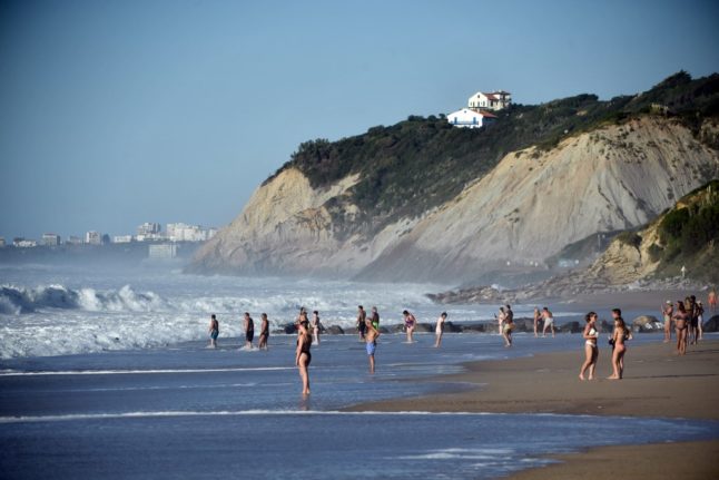
French weather authority Meteo-France said the September temperature average in the country will be around 21.5 degrees Celsius (70.7 degrees Fahrenheit), between 3.5C and 3.6C above the 1991-2020 reference period.

Average temperatures in France have been exceeding monthly norms consistently for almost two years.

In neighbouring Germany, weather office DWD said this month was the hottest September since national records started, almost 4C higher than the 1961-1990 baseline.

Poland’s weather institute announced September temperatures were 3.6C higher than average and the hottest for the month since records began more than 100 years ago.

National weather bodies in the Alpine nations of Austria and Switzerland also recorded their hottest-ever average September temperatures, a day after a study revealed Swiss glaciers lost 10 percent of their volume in two years amid extreme warming.

The Spanish and Portuguese national weather institutes warned abnormally warm temperatures were going to hit this weekend, with the mercury topping 35C in parts of southern Spain on Friday.

READ ALSO: MAP: The parts of Spain that are most and least affected by global warming

Records ‘systematically’ broken 

Scientists say climate change driven by human activity is driving global temperatures higher, with the world at around 1.2C of warming above pre-industrial levels.

The European Union’s Copernicus Climate Change Service told AFP earlier this month that 2023 is likely to be the hottest year humanity has experienced.

Higher temperatures are likely to be on the horizon as the El Nino weather phenomenon — which warms waters in the southern Pacific and beyond — has only just begun.

The disruption to the planet’s climate systems is making extreme weather events like heatwaves, drought, wildfires and storms more frequent and intense, causing greater losses of life and property.

World leaders will gather in Dubai from November 30 for crunch UN talks aimed at curbing the worst effects of climate change, including limiting warming to 1.5C, a goal of the landmark 2015 Paris Agreement.

Slashing planet-warming greenhouse gas emissions — notably by phasing out the consumption of polluting gas, oil and coal — climate finance and boosting renewable energy capacity will be at the heart of the discussions.

“Until we reach carbon neutrality, heat records are going to be systematically broken week after week, month after month, year after year,” UN climate report lead author Francois Gemenne told AFP this week.

Member comments

Log in here to leave a comment.
Become a Member to leave a comment.

FLOODS

Floodwaters recede in eastern France

The municipalities affected by floods in eastern France on Saturday are seeing a gradual return to normality on Sunday, although forecaster Météo-France has kept an orange alert in place for Moselle and Bas-Rhin.

Floodwaters recede in eastern France

“The floodwaters are receding well, we are in the process of removing all protective equipment,” said Bruno Minutiello, president of the municipalities community covering Lunéville to Baccarat (Meurthe-et-Moselle), without mentioning any significant incident.

On Saturday, this area was placed on red alert, France’s highest weather warning level, because of flooding on the Vezouze river, which burst its banks. It rose to 2.90 metres from 0.60 metres on Thursday. 

However, it fell short of reaching the level recorded during the 2006 floods, as had been feared. The river is now back on yellow alert.

“The night was quiet, no homes were flooded,” said the mayor of Lunéville, Catherine Paillard.

READ ALSO: What do France’s weather warnings actually mean?

In Moselle, the Nied river is also receding and has been downgraded to an orange alert on Sunday, from red on Saturday.

“The main street is clear, the waters have receded, all homes are accessible, whereas yesterday people had 1.50 metres of water in their houses,” said René Kupperschmit, mayor of Filstroff (Moselle), adding that the local kayak club had delivered food to some families.  

“The waters dropped back with incredible speed. Today people are cleaning up, I think that the prefect will issue a natural disaster order for the entire sector,” he added.

But further upstream, in Ancerville (Moselle), water levels were still high with the Nied reaching 2.64 metres on Sunday morning, compared to 0.65 metres on Thursday.

“There are still about 30 centimetres of water covering the two main roads making travel very difficult. But houses are not flooded, it’s mainly affecting travel,” said mayor Patrick Angelaud.

In the areas of Sarreguemines and Bouzonville (Moselle), there were still some difficulties on Sunday, after the Saar river flooded. It reached its peak of 6.40 metres in the morning, up from 2.60 metres on Thursday.

“Around 180 homes remain without electricity,” the prefecture said in a press release, noting that agents for power grid operator Enedis had been deployed to remedy the situation.

Firefighters carried out “84 interventions” in the morning, “mainly for pumping and reconnaissance”.

In the Lower Rhine area, “generally speaking, waters are starting to recede on the majority of waterways, even if some areas are still under surveillance”, the press release continued.

Around 20 roads in the department remain inaccessible, but “the situation is gradually returning to normal”.

A yellow alert for thunderstorms has been issued for 76 departments on Sunday, including those in the Grand Est region of northeastern France, amid fears of further rain.

SHOW COMMENTS