
Italy’s civil protection department issued severe weather warnings for much of the country on Monday, as a cold front moving in from the Atlantic brought intense rain, winds and hailstorms to the north and centre-north.
While many in Italy will have breathed a sigh of relief on hearing that the country’s week-long heatwave was coming to an end, the government has warned people in some areas to prepare for significant disruption from incoming storms.
READ ALSO: Storm warnings in Italy as heatwave set to break on Monday
A high-level ‘red’ risk alert was issued for Lombardy’s Valchiavenna area, with six regions receiving moderate ‘orange’ and 12 other areas lower-level ‘yellow’ warnings.
🌧⛈ Lunedì #28agosto piogge e temporali al Nord e al Centro-Sud
🔔🔴 Allerta ROSSA in Lombardia
🔔🟠Allerta ARANCIONE in 6 Regioni al Centro-Nord
🔔🟡Allerta GIALLA in 12 regioni
🔎 Leggi l’avviso di condizioni meteo avverse del 27 agosto https://t.co/wOJrpwfCFj pic.twitter.com/CbTuv77jZ0— Dipartimento Protezione Civile (@DPCgov) August 27, 2023
But what does the colour-coded storm alert system actually mean in practice, and what precautions should people take? Here’s a closer look.
‘Red’ alert
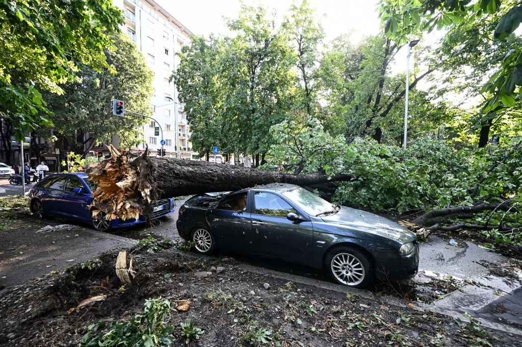
This is the most severe weather alert, warning of major landslides, collapsed bridges, rivers overflowing and diverting from their normal paths, and potential widespread flooding even in areas far from waterways.
Such a weather event could cause damage to buildings and city centres, as well as infrastructure, including roads, bridges and railway lines, and agricultural and industrial sites.
Crops are at risk of widespread destruction, the supply of basic goods and services could be disrupted, and fallen trees and branches could bring down communications networks.
There is a severe threat to public safety and human life.
‘Orange’ alert
An orange alert represents a moderate risk warning.
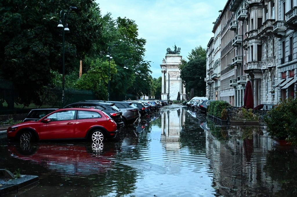
Regions placed under such an alert are at risk of small landslides, sinkholes, damage to buildings and settlements, and the flooding of floodplains.
Structures on or below ground level are at risk of flooding if they are in the vicinity of a waterway, and individual buildings, fields or worksites could be hit by landslides.
Roads and railways could become blocked, and the supply of goods, services and communications networks disrupted.
There is a threat to public safety and the risk that lives could be lost.
‘Yellow’ alert
A yellow warning is the least severe alert, but still indicates some level of risk.
River levels are likely to rise rapidly and waterways could become flooded, as could nearby underpasses, tunnels, and basement-level structures.
Roads and railway lines could become temporarily blocked, and utility and telecoms services could be disrupted.
There is the occasional threat to public safety and the possibility that lives could be lost in unforeseen events.
How should you prepare for a storm?
The civil protection department has released detailed guidelines on how to prepare for an extreme weather event and how to best protect yourself when one happens.
Before bad weather hits, you should:
- Inform yourself about where floods have occurred in the past in your area. If an area has flooded before, it’s likely to do so again.
- Ask your town council, as wells as schools and workplaces, for a flood protection plan including a map of escape routes and safe areas. If such a plan doesn’t exist, ask them to prepare one.
- Find out how your region sends out risk alerts and make sure you’re on their contact list. Italy’s government is currently rolling out a nationwide risk alert system.
- Keep an eye out for things like clogged drains and report any issues to your local authorities.
- Make sure your building allows easy for movement between levels.
READ ALSO: ‘IT-Alert’: How Italy will warn you of nearby emergencies via text
If you’re suddenly caught in rapidly rising floodwaters, you should:
- Turn off your water and electrics system, being careful not to touch electrics with wet hands.
- Move to the higher floors of the building you’re in, helping disabled people and the elderly to do so.
- Not go outside to move your car, as you could quickly become trapped in it.
- Avoid drinking tapwater, which could be contaminated.
- Limit your cellphone use to emergencies only, to avoid overloading the network.
- If you’re outside, be careful where you step, as water could conceal open manholes and other hazards.

Member comments