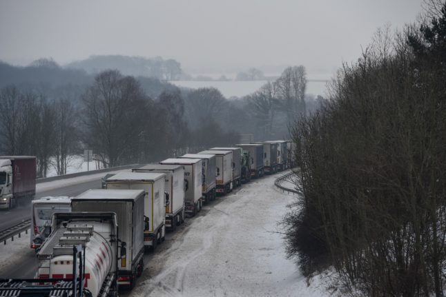
Starting this weekend, the wet and mild weather that soaked much of France over the Christmas and New Year holiday period is expected to be replaced by a freeze that could last for several days, with temperatures predicted to fall below zero in much of the country.
For the first time since February 2018, France’s national heat indicator – the national average of daytime and night-time temperatures – could dip below zero on Tuesday.
A partir de ce #weekend, les températures vont baisser. Un temps hivernal et froid va s'installer la semaine prochaine.
🥶Lundi et mardi, les maximales dépasseront rarement 0°C sur une bonne moitié est du pays, jusqu'à la région Centre et Ile de France
👉https://t.co/9boEkUDOkK pic.twitter.com/t3tMK3cTu0
— Météo-France (@meteofrance) January 4, 2024
On Saturday, the north-east is forecast to have its first local frosts of 2024, as cold air from the north and east spreads over the country.
Temperatures in northern France are not expected to get above 8C, while the south could see the mercury rise to 11C.
Starting on Sunday, the north-eastern quarter will likely see more serious frosts, with daily temperatures close to 0C in the Paris region; and no higher than 1C in Strasbourg, Clermont-Ferrand and Lille; and 2C in Rennes. Elsewhere, a high of 9C is forecast in Marseille, and 8C in Bordeaux.
READ ALSO ‘It’s duck cold!’: How the French complain about winter weather
In the south, however, strong chilly winds will make it feel much colder, notably in the Rhône Valley and around the Pyrénées-Orientales.
Cold air is expected settle over most of France from Monday. Morning frosts are forecast in most areas, while temperatures are likely to fall as low as -5C from the Massif Central to the eastern borders for a good part of the week. Some forecasts predict local temperatures as low as -10C.
Vague de #froid la semaine prochaine sur la France ! 📉
Des minimales parfois situées mardi matin entre -5 et -10 degrés ! 🥶
Toutes nos cartes ↩️https://t.co/7XlsIEREdi pic.twitter.com/mD2gM8zodi
— Meteored | tameteo (@MeteoredFR) January 5, 2024
At the start of the week, maximum temperatures will struggle to pass 0C in the eastern half of the country, as far north as the Ile de France, according to national forecaster Météo-France. In fact, only the coastal north-west, south-west, and around the Mediterranean are predicted to see daytime temperatures rise noticeably above freezing – though the wind chill may make it feel much colder.
🥶 C'est bien l'air très #froid actuellement situé sur la Scandinavie et la Russie >> https://t.co/WyaIizgZxM qui va envahir une bonne partie de l’Europe (y compris la France) dans les prochains jours (#Moscou-Paris). Notre bulletin ici >>> https://t.co/utXhJwztKG
Animation ICON… pic.twitter.com/OEfLbuxnTd— Guillaume Séchet (@Meteovilles) January 4, 2024
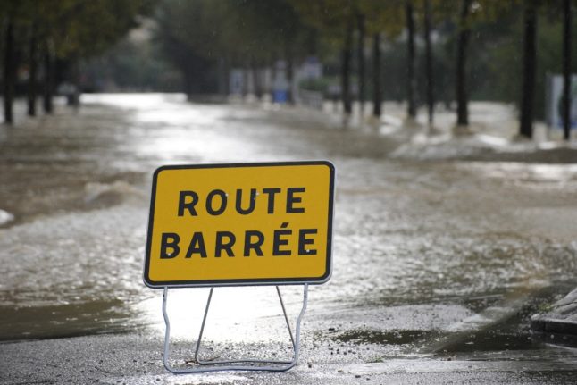
As of Friday, Météo-France, however, had not yet designated the upcoming cold period as a cold snap (vague de froid), which has a very specific definition.
For a cold snap to be declared, France must experience three consecutive days in which temperatures dip below -2C, and rise no higher than 0.9C. It officially ends when temperatures rise above 2.2C.
READ ALSO IN PICTURES: You think it’s cold in Paris now but look how chilly it got in days gone by
Cold snaps can also be characterised on a regional scale when cold spells last at least two days and temperatures are well below seasonal normals for the region concerned.
Member comments