Storm Domingos is expected to hit France on Saturday in the late afternoon, with some experts predicting 15-days-worth of precipitation falling in just 48 hours. The storm is expected to peak between 11pm and midnight.
11 French Departments have been issued with ‘orange alerts’ by the country’s meteorological agency, meaning residents of these areas should be ‘very vigilant’ in light of the weather conditions.
READ MORE How to ensure your French property is insured for storm damage
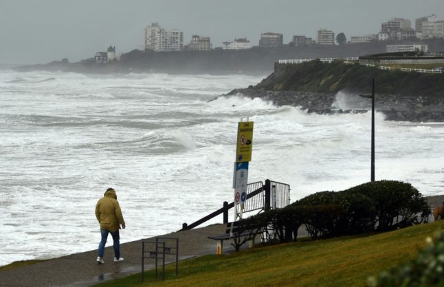
Along the west coast, Charente-Maritime and Gironde face a heightened risk of strong winds and coastal flooding, while strong winds are also expected in the Vendée, Deux-Sèvres, Vienne and Charente. Some of these areas are expected to see gusts of wind of up to 140 km/h.
In the south of France, coastal flooding is likely in Bouches-du-Rhône and the Var, while heavy rainfall also adds to the danger on the island of Corsica.
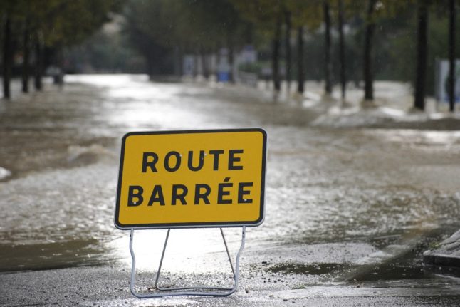
There is also a flood risk in the northern Department of Pas-de-Calais.
🔶 11 départements en Orange pic.twitter.com/RoFC2J54UP
— VigiMétéoFrance (@VigiMeteoFrance) November 4, 2023
This new storm comes as France is still reeling from Storm Ciaran, which claimed at least three lives in the country according to the latest figures. At least 14 other people have died elsewhere in Europe. As of Saturday morning 260,000 French households were still without electricity as a result of the storm damage.
“Facing this destruction, there is national mobilisation. Everything is being done to clear the roads and reestablish electricity. Be careful in the coming days,” said President Emmanuel Macron in a social media post on Friday.
Staying safe
France has issued official advice on how to stay safe in a storm.
In areas with strong winds, you should limit travel, avoid walking along the coast or in forests, and secure any objects that could fly away or be damaged.
In areas where there is a risk of coastal flooding, it is best to avoid going out to sea, avoid driving on roads that could be impacted by the swell, and keep an eye on rising sea levels.
As for other kinds of flooding, you should once again limit travel, avoid travelling on flooded roads, secure objects that could be damaged by water and consider alternative forms of lighting your home if the electricity is cut.
Member comments