SHARE
COPY LINK

WEATHER

IN PICTURES: Parts of France left submerged as flood waters rise

Parts of France remain on alert for floods as authorities struggle to deal with the fallout from the country's major rivers bursting their banks and leaving cities, villages and farms underwater. Here's a selection of the most dramatic images.

IN PICTURES: Parts of France left submerged as flood waters rise
Villeneuve-Saint-Georges. Photo: AFP

In total, 15 departments were on orange alert for flood risk on Thursday morning, according to France's national weather agency Meteo France.

Orange is the second highest alert and when in place people are advised “to be very vigilant” due to the danger. The public are advised to stay away from the water's edge. 

The 15 departements were Aube, Doubs, Jura, Marne, Haute-Marne, Meuse, Saône-et-Loire, Paris, Seine-et-Marne, Yvelines, Yonne, Hauts-de-Seine, Seine-Saint-Denis, Val-de-Marne and Val-d'Oise.

Four other departments, Puy-de-Dome, Loire, Cantal and Haute-Loire were on alert for snow and ice. 
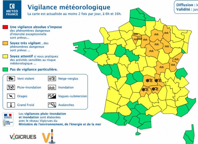
Map: Meteo France

In Val-de-Marne to the south east of Paris, military trucks have arrived to help evacuate residents of the town. Elsewhere in France, including Paris, transport lines and school bus services have been shut down and river banks across swathes of the country are no go zones. 

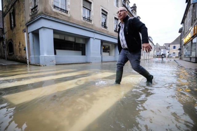
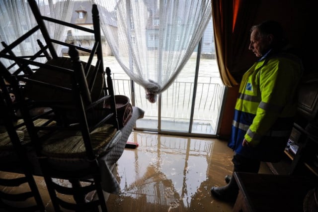
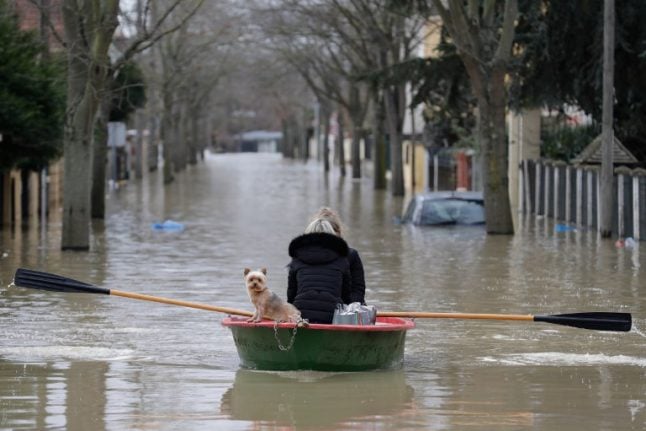
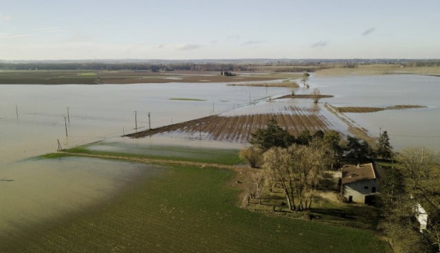
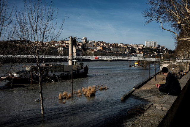
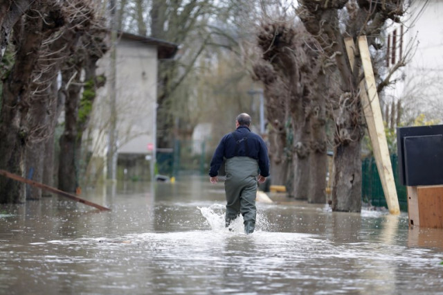
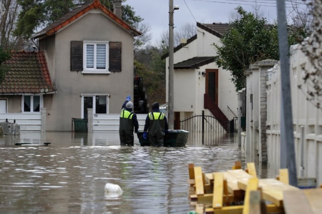
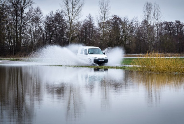
Here are some of the most dramatic images from the floods:

Tonneins, Lot-et-Garonne

The swollen river Rhone in Lyon

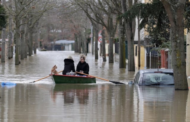
Crosne, Ile-de-France

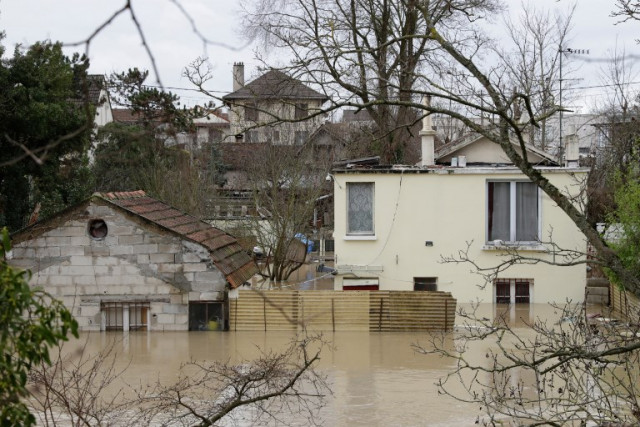
Villeneuve-Saint-Georges, Paris suburbs

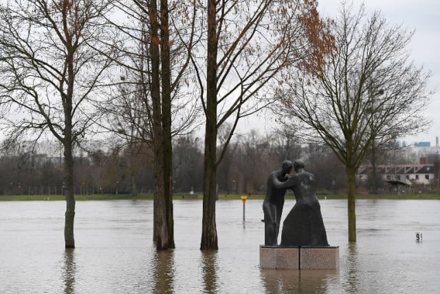
Kehl, at the French-German border

Benfeld, eastern France
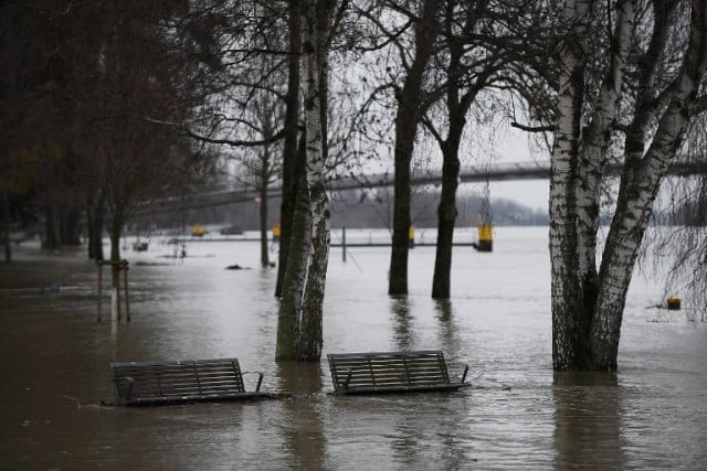
Grigny, Essonne

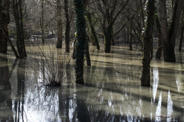
Ornans, eastern France

WEATHER

Denmark records deepest snow level for 13 years

Blizzards in Denmark this week have resulted in the greatest depth of snow measured in the country for 13 years.

Denmark records deepest snow level for 13 years

A half-metre of snow, measured at Hald near East Jutland town Randers, is the deepest to have occurred in Denmark since January 2011, national meteorological agency DMI said.

The measurement was taken by the weather agency at 8am on Thursday.

Around 20-30 centimetres of snow was on the ground across most of northern and eastern Jutland by Thursday, as blizzards peaked resulting in significant disruptions to traffic and transport.

A much greater volume of snow fell in 2011, however, when over 100 centimetres fell on Baltic Sea island Bornholm during a post-Christmas blizzard, which saw as much as 135 centimetres on Bornholm at the end of December 2010.

READ ALSO: Denmark’s January storms could be fourth extreme weather event in three months

With snowfall at its heaviest for over a decade, Wednesday saw a new rainfall record. The 59 millimetres which fell at Svendborg on the island of Funen was the most for a January day in Denmark since 1886. Some 9 weather stations across Funen and Bornholm measured over 50cm of rain.

DMI said that the severe weather now looks to have peaked.

“We do not expect any more weather records to be set in the next 24 hours. But we are looking at some very cold upcoming days,” DMI meteorologist and press spokesperson Herdis Damberg told news wire Ritzau.

SHOW COMMENTS