SHARE
COPY LINK

WEATHER

Jet stream brings warmer Swiss conditions

Winter is still holding a tenacious grip on many parts of Switzerland, well past the official start of spring last month, but weather forecasters are finally promising relief this weekend.

Jet stream brings warmer Swiss conditions
Photo: Carl Court/AFP/Getty Images

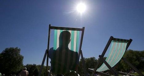
Temperatures are set to hit as much as 20 degrees this weekend in parts of the country for the first time this year, bringing an end to what has been a cooler than usual start to the shoulder season.

With snow sitting heavy in the mountains above 1,000 metres, the mercury is expected to start heading upwards on Thursday.

Since March 20th, the jet stream, bringing warm air from the west, has flowed well south of Switzerland, exposing the mountain country to cool air from eastern Europe, aided by the bise, a cold wind from the northeast, MeteoSwiss, the national weather office said.

“This week finally, the western current will finally return to a more normal route,” the weather office said in a statement.

Mild, moist air is set to blow across the country on Thursday, while a high pressure system with clear skies is expected to move into place on Sunday bringing high temperatures ranging from 17 to 20 degrees, MeteoSwiss said. 

In the southeren Alps, it should rise to between 18 and 20 degrees on Saturday, according to forecasts.

There is still a risk of snow at higher elevations in the Alps in the next few days.

But the limit for precipitation falling as snow is set to rise to 3,000 metres from the current 1,000 to 2,000 metres by the weekend, meteorologist Christine Jutz from public broadcaster SRF told the ATS news agency.

Milder, spring-like weather is expected to continue across Switzerland through next week.

Member comments

Log in here to leave a comment.
Become a Member to leave a comment.

WEATHER

IN PICTURES: ‘Exceptional’ Sahara dust cloud hits Europe

An "exceptional" dust cloud from the Sahara is choking parts of Europe, the continent's climate monitor said on Monday, causing poor air quality and coating windows and cars in grime.

IN PICTURES: 'Exceptional' Sahara dust cloud hits Europe

Copernicus Atmosphere Monitoring Service said the latest plume, the third of its kind in recent weeks, was bringing hazy conditions to southern Europe and would sweep northward as far as Scandinavia.

Mark Parrington, senior scientist at Copernicus, said the latest event was related to a weather pattern that has brought warmer weather to parts of Europe in recent days.

“While it is not unusual for Saharan dust plumes to reach Europe, there has been an increase in the intensity and frequency of such episodes in recent years, which could be potentially attributed to changes in atmospheric circulation patterns,” he said.

This latest episode has caused air quality to deteriorate in several countries, Copernicus said.

The European Union’s safe threshold for concentrations of PM10 — coarser particles like sand and dust that that can irritate the nose and throat — has already been exceeded in some locations.

A picture taken on April 8, 2024 shows a rapeseed field under thick sand dust blown in from the Sahara, giving the sky a yellowish appearance near Daillens, western Switzerland. – An “exceptional” dust cloud from the Sahara is choking parts of Europe, the continent’s climate monitor said, causing poor air quality and coating windows and cars in grime. (Photo by Fabrice COFFRINI / AFP)

The worst affected was the Iberian Peninsula in Spain but lesser air pollution spikes were also recorded in parts of Switzerland, France and Germany.

READ ALSO:

Local authorities in southeastern and southern France announced that the air pollution threshold was breached on Saturday.

They advised residents to avoid intense physical activity, particularly those with heart or respiratory problems.

The dust outbreak was expected to reach Sweden, Finland and northwest Russia before ending on Tuesday with a shift in weather patterns, Copernicus said.

The Sahara emits between 60 and 200 million tonnes of fine dust every year, which can travel thousands of kilometres (miles), carried by winds and certain meteorological conditions.

The Spanish Canary Islands off the coast of northwest Africa saw just 12 days within a 90-day period from December to February where skies were free of Saharan dust, the local weather agency Aemet had reported.

SHOW COMMENTS