SHARE
COPY LINK

WEATHER

Summer delayed again with more gloomy weather ahead

The German Weather Service (DWD) is forecasting another week of gloomy weather for the country as storm warnings were issued for parts of southern Germany.

Summer delayed again with more gloomy weather ahead
Photo: DPA

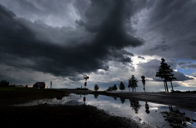
Grey skies and wet conditions are expected to dominate the Alpine regions especially, where heavy showers are expected all week, with 60 to 90 litres of rain per square metre forecast to fall by Tuesday.

The DWD has issued storm warnings for the next two days – until Tuesday morning – in the southern states of Bavaria and Baden-Württemberg. The grey weather is expected to continue after that, though it will get milder towards the end of the week, and more summery conditions could finally break out next weekend.

Click here for The Local’s weather forecast.

But the outlook on Monday is particularly bleak, with constant rain expected in eastern Germany, and constant rain forecast in mountainous areas. Temperatures will hover between 13 and 17 degrees Celsius. Only western Germany, where the rain may hold off, has a chance of seeing 20 degrees.

The rain will then move westwards on Tuesday, though it will stay cloudy all over the country. The DWD believes the cloud cover could begin to break up on Wednesday.

Member comments

Log in here to leave a comment.
Become a Member to leave a comment.

WEATHER

Severe weather warnings issued as Germany braces for more storms

Extreme weather warnings for heavy rainfall remain in place in parts of Germany on Friday following flooding in the south. There is also a chance of thunderstorms at the weekend.

Severe weather warnings issued as Germany braces for more storms

Severe weather is expected in the southwest of the country on Friday, with the heaviest rain expected in Saarbrücken, as well as the surrounding areas of Saarland and southern Rhineland-Palatinate.

In these areas Germany’s weather service (DWD) has level 4 warnings in place – meaning that the rain is expected to be extremely heavy (more than 40 litres per square metre in an hour, or 60 litres per square metre in 6 hours).

Slightly less severe, but still heavy continuous rain can also be expected in the surrounding regions, extending as far as Stuttgart and Mainz.

Speaking to Bild newspaper, Climatologist Dr. Karsten Brandt suggested that the heavy precipitation and thunderstorms will continue to move northwest, even into southern North-Rhine Westphalia (Aachen).

There are also wind warnings in parts of the country, with squalls expected on the Brocken and the Fichtelberg mountains, as well as in the Black Forest and in the Alps.

Currently, the highest wind warnings are in Dresden and southern Bavaria near the Alps.

Friday’s weather warnings come in the wake of chaotic weather that flooded Nuremberg and parts of Bavaria Thursday night, where many roads flooded. Cars were submerged in water and bus routes were cancelled.

A number of household cellars also flooded as well as a large underground car park at the Technical University.

READ ALSO: Record heat deaths and floods – How Germany is being hit by climate change

What will the weekend bring?

Beyond the area of severe weather warnings but not beyond the reach of the storm, Cologne will have some rain on Friday which may continue on through the weekend.

Germany’s northern and eastern regions have dodged the recent bout of storms so far, but in Berlin scattered thunderstorms can be expected to move in by Sunday afternoon. This may put a dampener on the Karneval der Kulturen parade. 

In Bremen and Hamburg, residents can expect some rain showers on Sunday and Monday, with a chance of thunderstorms as well.

In Munich and Nuremberg, it looks as if the worst is over. Some small showers may continue into Saturday, but Bavarian residents can look forward to a sunny Sunday ahead of the public holiday on Monday for Pentecost. 

READ ALSO:

SHOW COMMENTS