Although it’s not even March, Switzerland has been experiencing spring-like weather in several parts of the country.
Temperatures in the Alps have repeatedly gone above 10C, meaning various ski resorts have had to scrape together the last remnants of snow for the February holidays, often called the Sportferien in German-speaking Switzerland and vacancies des ski in French.
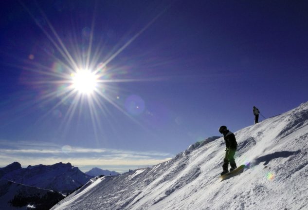
Due to the lack of snow, several ski resorts have been relying on alternative programmes for their slopes such as mini golf, hiking and swimming to keep families entertained.
But one ski resort is seeing record amounts of snow –
READ ALSO: Do Swiss ski resorts have enough snow for the February holidays?
Where is there lots of snow?
In the early hours of Monday, there was some fresh snowfall again. In the last few days, around 10 centimetres of snow is likely to have fallen in the Alps, according to a report by the Swiss news site 20 Minuten.
The snow line on Tuesday was expected to drop to around 1,000 to 1,200 metres with 15 to 30 cm of fresh snow above 1,600 metres on the northern slopes of the Alps.
READ ALSO: How to check if there’s snow on the slopes
MeteoSwiss, Switzerland’s national weather service, declared a snow danger level 2 (low to medium) for some regions of Switzerland from Sunday night until Tuesday morning.
However, while there is almost no snow at lower altitudes, the white stuff is piling up in some places.
The operators of the Glacier 3000 resort near Les Diablerets in the canton of Vaud have seen “almost eight metres” of snowfall since November.
Bosses said last week that the ski area is “currently breaking all records”.
Huit mètres depuis novembre!: Le domaine skiable Glacier 3000 enregistre des quantités de neige recordhttps://t.co/gWOR29HZEB
— nessie (@morninglakegene) February 15, 2024
There’s around 2.72 metres of snow at the SLF Tsanfleuron measuring station, which lies at 2,569 metres above sea level.
According to operators of the resort, a lot of snow has fallen above 2000 metres this season. At the summit of the Les Diablerets station, the total precipitation in the form of snow was 40 percent higher than at the same time last year, while the snow cover is 65 percent thicker.
Despite the mild weather, the snow has not melted away, especially at higher altitudes.
According to MeteoSwiss, there is around 2 metres of snow on the Weissfluhjoch in Graubünden at 2,540 metres above sea level – the long-term average at this time of year is around 1.6 metres. The Säntis in the Appenzell Alps at 2,226 metres reports just under five metres with a long-term average of just over 3 metres.
Glacier 3000 Switzerland 🇨🇭🚴♂️ pic.twitter.com/WaZ8mrpUKZ
— Zaman Hakimi (@Hakimi7Zaman) February 13, 2024
In other places, the snow has mostly melted. In Sils-Maria in the Upper Engadine (at 1,801 metres above sea level), there is currently around 60 centimetres of snow, which is just below the long-term average.
Andermatt at 1,440 metres above sea level has just over 50 centimetres of snow. The long-term average at this time of year is around one metre.
Why are there such differences? This winter, the snow line has been between 1,000 and 2,000 metres. While this means there is a lack of snow at lower altitudes, there can also be very high or even above-average amounts of snow above this level, depending on the location.
At Glacier 3000, the extra snow has meant a lot of extra work.
A total of 4.5 metres of snow fell in November alone, meaning workers had to clear a lot of the extra snow to make sure everything was in order.
What’s the forecast for the rest of the week?
Temperatures are expected to remain mild for the time of year.
It will be warmest on Thursday with highs of 14C, although there will be widespread rain throughout Switzerland. The snow line is expected to lie between 1,800 and 2,200 metres. In the Alpine valleys there will be a strong warm wind.


Member comments