SHARE
COPY LINK

WEATHER

Weather update: What to expect during France’s icy spell this week

After weeks of mild weather, temperatures have fallen below seasonal norms across France for the first time this winter, and the chilly period is set to last several days.

Weather update: What to expect during France's icy spell this week
An ice-covered street in Mulhouse, eastern France, on January 8, 2024. (Photo by SEBASTIEN BOZON / AFP)

Several local authorities in France have unlocked their ‘severe cold’ plans as temperatures plummet.

Paris triggered its plan on Monday, following in the footsteps of a number of prefectures including Meurthe-et-Moselle, Cantal and Haut-Rhin – the latter of which triggered its level 1 plan on Saturday. 

This means that prefectures open additional emergency accommodation places in buildings which usually have another use, such as gymnasiums or schools, to provide shelter for those who are most vulnerable to the cold. 

Elsewhere, Hauts-de-Seine, Bas-Rhin and Loire-Atlantique were among the départements to have stepped up prevention and vigilance programmes. 

What about the rest of the week?

Tuesday, January 9th is set to be the coldest day of the spell, with forecasters now predicting that overnight temperatures in certain higher-altitude parts of the country could fall as low as -15C.

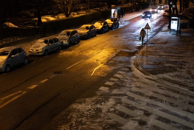
Frosts were widespread across the northern half of the country on Monday, as children headed back to school after the Christmas holidays. Temperatures dipped as low as -4C in Amiens and Lille, -3C in Paris and Belfort, and -2C in Metz and Rouen.

Forecasters warned that temperatures would struggle to get above zero in the north and east of France, while a strong wind would make it feel colder still.

On Tuesday, the cold is expected to take hold across the whole of the country, with a large part of France seeing the mercury dip below freezing overnight and the average daily temperature expected to fall into negative figures for the first time since 2018.

Forecasters predict -5C in Strasbourg, Clermont-Ferrand, Agen and Lille; -4C in Bordeaux; -3C in Dijon, La Rochelle, Montpellier and Toulouse; -2C in Lyon or Brest; even -1C in Perpignan.

In Paris, meanwhile, the mercury is not expected to get any higher than -2C, Météo-France has said, adding that the capital could see temperatures stuck below zero for the remainder of the week.

Locally, Météo-France is forecasting temperatures down to “-10C, even -15C in cold spots. On Tuesday, “we’ll be 5C to 8C below seasonal normals nationwide”. 

Conditions are set to remain glacial in the northern half of the country on Wednesday and into Thursday, but clouds in the south mean temperatures will start to rise, with the prospect of snow around the Rhône valley.

Member comments

Log in here to leave a comment.
Become a Member to leave a comment.

FLOODS

Floodwaters recede in eastern France

The municipalities affected by floods in eastern France on Saturday are seeing a gradual return to normality on Sunday, although forecaster Météo-France has kept an orange alert in place for Moselle and Bas-Rhin.

Floodwaters recede in eastern France

“The floodwaters are receding well, we are in the process of removing all protective equipment,” said Bruno Minutiello, president of the municipalities community covering Lunéville to Baccarat (Meurthe-et-Moselle), without mentioning any significant incident.

On Saturday, this area was placed on red alert, France’s highest weather warning level, because of flooding on the Vezouze river, which burst its banks. It rose to 2.90 metres from 0.60 metres on Thursday. 

However, it fell short of reaching the level recorded during the 2006 floods, as had been feared. The river is now back on yellow alert.

“The night was quiet, no homes were flooded,” said the mayor of Lunéville, Catherine Paillard.

READ ALSO: What do France’s weather warnings actually mean?

In Moselle, the Nied river is also receding and has been downgraded to an orange alert on Sunday, from red on Saturday.

“The main street is clear, the waters have receded, all homes are accessible, whereas yesterday people had 1.50 metres of water in their houses,” said René Kupperschmit, mayor of Filstroff (Moselle), adding that the local kayak club had delivered food to some families.  

“The waters dropped back with incredible speed. Today people are cleaning up, I think that the prefect will issue a natural disaster order for the entire sector,” he added.

But further upstream, in Ancerville (Moselle), water levels were still high with the Nied reaching 2.64 metres on Sunday morning, compared to 0.65 metres on Thursday.

“There are still about 30 centimetres of water covering the two main roads making travel very difficult. But houses are not flooded, it’s mainly affecting travel,” said mayor Patrick Angelaud.

In the areas of Sarreguemines and Bouzonville (Moselle), there were still some difficulties on Sunday, after the Saar river flooded. It reached its peak of 6.40 metres in the morning, up from 2.60 metres on Thursday.

“Around 180 homes remain without electricity,” the prefecture said in a press release, noting that agents for power grid operator Enedis had been deployed to remedy the situation.

Firefighters carried out “84 interventions” in the morning, “mainly for pumping and reconnaissance”.

In the Lower Rhine area, “generally speaking, waters are starting to recede on the majority of waterways, even if some areas are still under surveillance”, the press release continued.

Around 20 roads in the department remain inaccessible, but “the situation is gradually returning to normal”.

A yellow alert for thunderstorms has been issued for 76 departments on Sunday, including those in the Grand Est region of northeastern France, amid fears of further rain.

SHOW COMMENTS