SHARE
COPY LINK

WEATHER

Spain’s cold snap worsens with snow and freezing temperatures on the way

The arrival of a new cold weather front will bring snow, frost and freezing temperatures to large parts of Spain, with several regions placed on alert by the country's national weather agency.

Spain's cold snap worsens with snow and freezing temperatures on the way
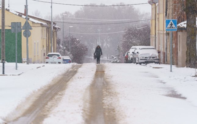
The arrival of a DANA could bring snowy conditions to large swathes of Spain. Photo: Cesar Manso/AFP.

Spain’s cold spell is set to get worse over the coming days as the state meteorological agency (Aemet) puts out warnings for snow, frosts, freezing temperatures and strong winds.

From Tuesday (January 9th) the wintery weather will intensify with the entry of a DANA (literally Depresión Aislada en Niveles Altos in Spanish, and what we might call a ‘cold weather front’ in English) that could bring snowfall to some parts of the country that will last through Wednesday 10th and Thursday 11th. 

READ ALSO: Spanish Word of the Day: DANA

According to an Aemet statement: “An episode of snow is expected to begin on Tuesday 9th and last through Wednesday 10th and Thursday 11th, with precipitation in practically the whole of the peninsula and the Balearic Islands, though less likely in Galicia.”

However, the agency notes the picture with regards to where the snow might fall is still unclear: “There is still high uncertainty regarding snow cover and precipitation intensity due to the uncertainty associated with the position and deepening of the DANA.”

Nonetheless, six regions have also been put on alert for strong winds, waves and low temperatures from Monday, January 8th, in which minimum temperatures will plummet and frosts could affect large swathes of inland Spain.

A Meteored graphic below visualises the spread of frosts and freezing temperatures over the coming days: “In the next few days frosts will spread over many areas of the inland peninsula, and locally they will be intense. At points in the Pyrenees and the Cantabrian Mountains it could drop below -15C.”

The regions on alert are Aragón, the Balearic Islands, Castile and León, Catalonia, Madrid and the Valencian Community, all of which have a yellow or orange alert prior to the arrival of the DANA, something that Aemet says could cause snowfall throughout mainland Spain and even the Canary Islands and the Balearic Islands. 

In provincial capitals such as Madrid and Cordoba, the mercury could even drop below 0C, and in Castellón, Girona, Lleida, Tarragona and Huesca winds of up to 80km/h are forecast.

However, the most likely scenario seems to be that snowfall will arrive on Tuesday in the more mountainous areas of Spain, the eastern area of the southern plateau and the west, although there could also be precipitation and perhaps light snow in large areas of the northern half of the country. 

On Wednesday, precipitation will be heavier, except in the southwest of the country. Specifically, snowfall is expected in the Cantabrian mountains, the northern plateau and Pyrenees, and could be heavy in the east of the country.

The snow and rain will begin to die off from Thursday, when it will be restricted to the north of the country and the Balearic Islands, except for the extreme northeast and Ebro valley area, where it will snow more heavily.

As far as daytime temperatures are concerned, Aemet forecasts that they will only reach 5C in coastal areas and in the Guadalquivir valley area on Tuesday, and on the coast on Wednesday and Thursday.

The cold snap will be compounded by strong winds wind, which will blow from the east in the Ebro valley and the Balearic Islands and make temperatures feel colder.

The cold snap brought on by the DANA is expected to last at least until Friday 12th.

Member comments

Log in here to leave a comment.
Become a Member to leave a comment.

WEATHER

Will this summer in Spain be as hot as the previous two?

2023 was the world’s hottest summer on record, with many countries including Spain experiencing scorching temperatures. What are meteorologists forecasting for summer 2024?

Will this summer in Spain be as hot as the previous two?

2023 was in fact the second-hottest summer Spain had ever experienced – the hottest being just one year earlier in 2022.

During that year, 11,300 people died in Spain alone due to the abnormally high temperatures, marine life perished in the warming seas and even train tracks warped and became deformed.

All eyes are looking toward this summer to see what will happen and if it will be as roasting as the previous two. 

READ ALSO:

According to the climate service Copernicus-EU, above-normal temperatures are predicted across southern Europe this summer.

And in Spain, there is a 50-70 percent chance that this summer will be one of the hottest 20 percent on record, and it will properly begin in June.

According to Spain’s State Meteorological Agency AEMET, we have already seen an abnormal rise this May.

Its quarterly prediction, which will take us up to the end of July (typically the hottest part of the summer here in Spain), states that it will almost certainly be warmer than usual on the Mediterranean side of the country, as well as the Balearic and Canary Islands.

Copernicus agrees with these predictions and has indicated that it’s very likely to be hotter than normal in certain areas of the country. It particularly singled out the Valencia region, Murcia (except the south), northern Almería and Granada, Ibiza and Formentera and the western Canary Islands.

It’s getting more and more difficult to know exactly what ‘above normal’ temperatures are, considering what Spain has experienced the last few years, but the reference period that many experts are basing their predictions on is from 1991-2020.

When it comes to rainfall, Copernicus has forecast that the “most likely scenario is a summer with less rain” than usual.

AEMET agreed with the prediction, stating on its X account that “most likely rainfall will be less throughout the country than what is already normally scarce in the summer season”.

This is bad news for many parts of Spain, such as Catalonia, Andalusia and the Canary Islands, which have already been experiencing an ongoing drought over the past two years.

Luckily, spring rains have managed to fill reservoirs just enough to see us through the summer at this point, but more rain will definitely be needed come autumn.

READ ALSO: Will drought restrictions affect summer holidays in Spain?

While scientists agree the sizzling temperatures experienced over the past few summers are down to climate change, last year in 2023, the cyclical phenomenon known as El Niño also had a part to play in global weather patterns.

When the seas become cooler on average and it has a cooling effect on the planet, this is partly down to the effect of La Niña.

This year is supposed to be dominated by La Niña and according to the National Oceanic and Atmospheric Administration in the US, La Niña has a 49 percent chance of developing between June and August and a 69 percent chance between July and September.

But this doesn’t necessarily mean that this summer will be cooler than last year.

As of May 16th 2024, we’re undergoing a neutral period known as El Niño–Southern Oscillation (ENSO).

Despite the global cooling effect of La Niña in 2022, it was still the planet’s sixth hottest year and the hottest in Spain ever recorded.

SHOW COMMENTS