SHARE
COPY LINK

WEATHER

Italy braces for ‘real winter’ with temperatures set to dip

Much of Italy is expected to see heavy rain and a major dip in temperatures this weekend in what forecasters say will be the start of "real winter" for the country.

Rain, Rome
A woman crosses a bridge over the Tiber river in Rome. Photo by FILIPPO MONTEFORTE / AFP

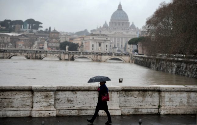
After experiencing relatively clement weather conditions and unseasonably warm temperatures for the most part of December, much of Italy is set to get a taste of “real winter” this weekend, forecasters warned on Friday.

Regions in the north and centre of the peninsula were warned to expect stormy conditions and heavy rain starting from Friday afternoon, with western Lombardy, Trentino Alto Adige, Friuli, Veneto and Emilia Romagna forecast to be amongst the most heavily hit areas.

Southern regions and the two major islands, Sicily and Sardinia, were also expected to see rainfall over the Epiphany weekend, though overall conditions were expected to be less severe there.

The incoming front was forecast to cause a five- to seven-degree drop in temperatures across the entire length of the country, with daytime readings expected to stand somewhere between 2 to 6 degrees in the north and centre, and between 6 and 10 in the south and major islands.

Experts said the dip in temperatures would favour snowfall in the Alps, with locations standing at 1000 metres or above likely to see generous amounts of snow (up to 40 centimetres in some areas) during the weekend. 

But the latest projections suggested that multiple high-altitude locations in the Apennines – including areas of Marche, Umbria and Abruzzo – may also experience snowfall for the first time this year, though much will depend on local daytime temperatures.

At the time of writing, there was no clear indication as to how long the incoming storm front would linger over the country, though some forecasters said stormy conditions may well continue into next week, albeit with lower overall intensity compared to the weekend.

Member comments

Log in here to leave a comment.
Become a Member to leave a comment.

WEATHER

IN PICTURES: ‘Exceptional’ Sahara dust cloud hits Europe

An "exceptional" dust cloud from the Sahara is choking parts of Europe, the continent's climate monitor said on Monday, causing poor air quality and coating windows and cars in grime.

IN PICTURES: 'Exceptional' Sahara dust cloud hits Europe

Copernicus Atmosphere Monitoring Service said the latest plume, the third of its kind in recent weeks, was bringing hazy conditions to southern Europe and would sweep northward as far as Scandinavia.

Mark Parrington, senior scientist at Copernicus, said the latest event was related to a weather pattern that has brought warmer weather to parts of Europe in recent days.

“While it is not unusual for Saharan dust plumes to reach Europe, there has been an increase in the intensity and frequency of such episodes in recent years, which could be potentially attributed to changes in atmospheric circulation patterns,” he said.

This latest episode has caused air quality to deteriorate in several countries, Copernicus said.

The European Union’s safe threshold for concentrations of PM10 — coarser particles like sand and dust that that can irritate the nose and throat — has already been exceeded in some locations.

A picture taken on April 8, 2024 shows a rapeseed field under thick sand dust blown in from the Sahara, giving the sky a yellowish appearance near Daillens, western Switzerland. – An “exceptional” dust cloud from the Sahara is choking parts of Europe, the continent’s climate monitor said, causing poor air quality and coating windows and cars in grime. (Photo by Fabrice COFFRINI / AFP)

The worst affected was the Iberian Peninsula in Spain but lesser air pollution spikes were also recorded in parts of Switzerland, France and Germany.

READ ALSO:

Local authorities in southeastern and southern France announced that the air pollution threshold was breached on Saturday.

They advised residents to avoid intense physical activity, particularly those with heart or respiratory problems.

The dust outbreak was expected to reach Sweden, Finland and northwest Russia before ending on Tuesday with a shift in weather patterns, Copernicus said.

The Sahara emits between 60 and 200 million tonnes of fine dust every year, which can travel thousands of kilometres (miles), carried by winds and certain meteorological conditions.

The Spanish Canary Islands off the coast of northwest Africa saw just 12 days within a 90-day period from December to February where skies were free of Saharan dust, the local weather agency Aemet had reported.

SHOW COMMENTS