DMI issued a Category Three flood warning for the northern coast of Funen and the northern coast of Zealand and the northern part of the Øresund, with the Odense Å, Isefjord and Roskilde Fjord the worst hit areas.
“There is a risk that breakwaters can be breached and that water can flow down to low-lying areas inland, where there are roads and houses,” meteorologist Hans Peter Wandler told the Ritzau newswire.
He said that the worst hit areas would be around Odense Å, Isefjord and Roskilde Fjord, where water levels are expected to hit their maximum more than 12 hours after the storm hits on Thursday afternoon.
“The wind is simply pushing the water in from the North Sea, in through the Skagerrak and then down through the Kattegat,” he said, adding that the islands of Funen and Zealand will then act “like a kind of traffic jam”.
“This is why we are going to see water piling up at Odense Å, Isefjord and Roskilde Fjord.”
How high could the waters get?
On the north coast of Funen, the agency expects water levels between 1.5m and 1.7m above normal, while on the North coast of Zealand and the Roskilde Fjord it expects waters between 1.5m and 1.9m above normal.
This is close to being a “100-year-event”, which according to Danish Coastal Authority records, is classed as a sea-level rise of 1.75 metres or more.
However, it likely to be slightly less than the storm surges that hit the southern coasts of Odense and Zealand as recently as October, whem sea levels were in places between 1.9m and 2.4m above normal.

What should people do to protect themselves?
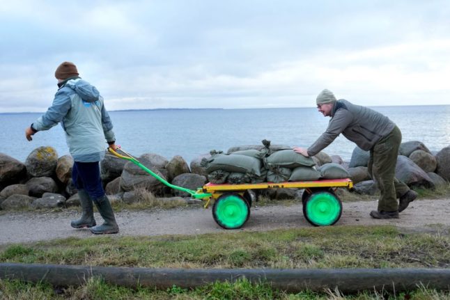
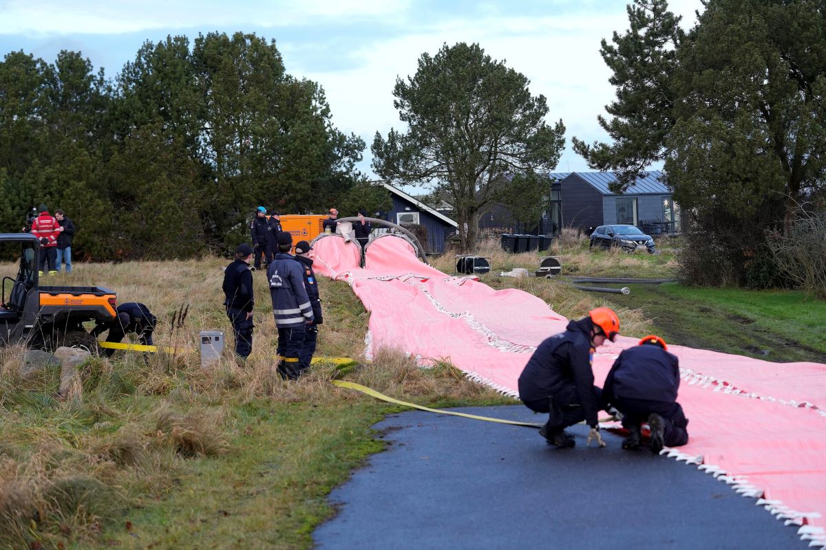
Wandler said that people living in the worst-affected areas should move valuables out of their cellars and take them upstairs and should also consider putting sandbags around their properties.
The emergency services in northern Jutland said in a post on X that people in the area should lock all doors, get sandbags ready, and be careful not to come into contact with sewage flushed out by the flooding.
How bad will the winds get?
The forecaster has issued a lesser Category Two warning for strong winds, which covers practically all of Denmark’s coastal areas with the exception of the south-east coast of Zealand.
It expects storm winds of between 25 and 28 m/s between Thursday afternoon and early Friday morning, with hurricane force gusts of between 33 and 25 m/s.
Evacuations
The rental company KAB on Thursday morning ordered the evacuation of 86 appointments in the Bellahøjhusene high-rise apartment bulidings in Copenhagen.
The apartments, from the 1950s, have a construction defect which means that they cannot safely withstand winds of more than 14 m/s.
The residents will be taken by buses to a hote in Copenhagen between 2pm and 5pm on Thursday and returned to their apartments on Friday.

Member comments