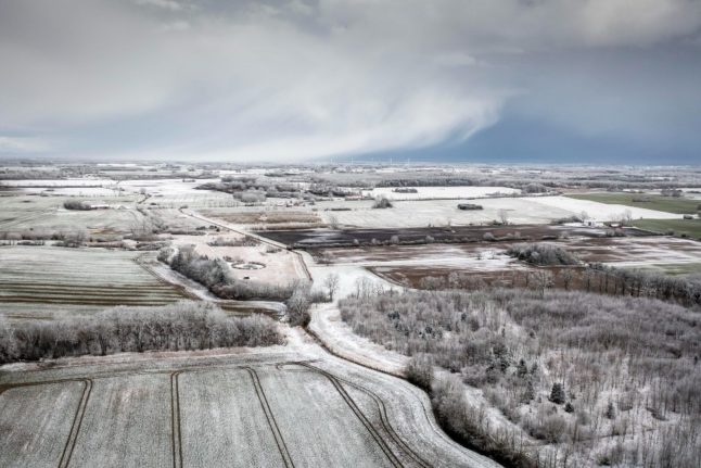
Tuesday’s snow was mostly confined to coasts of the Kattegat sea off the east coast of Jutland, as well as in the northwestern parts of the peninsula.
These areas are the most likely to continue to see a white covering on the ground as the week continues, broadcaster DR reports.
That appears in line with the seven-day forecast from Met office DMI, which has temperatures ranging from 3 degrees Celsius to 5 below freezing during the day, and down to -8 Celsius at night over the next week.
Cold winds will continue to flow across Denmark throughout the week, with only a lower pressure front possibly changing the weather in the west of the country this weekend.
A smaller low front passing to the south of Denmark will bring snow to South Jutland and the Baltic Sea, meanwhile.
Tonight could meanwhile see more widespread and heavier snow than has fallen in the last two days.
Parts of Zealand could see some snow on Tuesday night, along with North and northeastern Jutland. Heavier weather focused around northern Germany could also mean deeper snow in the parts of Denmark close to the German land border, as well as on the islands of Lolland and Falster.
Wednesday morning brings a risk of persistent snow along with potentially icy conditions in North Jutland and the Baltic Sea, including Bornholm, Møn and Falster. A separate weather system could mean persistent snow in the southeastern trekantsområde of Jutland and western Funen.
By Thursday, over 10 centimetres of snow could fall in northwestern Jutland and on the Baltic Sea coasts.
Member comments