SHARE
COPY LINK

WEATHER

Italy braces for another heatwave with temperatures set to soar

Italian meteorologists predict a third heatwave of the summer, as a high pressure system sweeps in from Africa, pushing temperatures in Italy up to 42 degrees.

Italy braces for another heatwave with temperatures set to soar
A man puts his head in the water to cool off at the fountain in Piazza del Popolo in Rome. (Photo by Tiziana FABI / AFP)

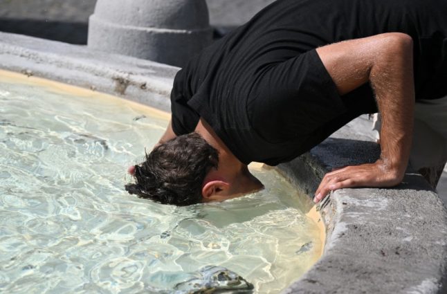
Higher temperatures are expected again in Italy this weekend, especially in the central regions, according to weather website Il Meteo.

Between Saturday 19th and Sunday 20th August, an African high pressure weather system will move in and strengthen over the country.

This will see the mercury rise to “extreme” temperatures in what’s being described as a “weekend on fire”, according to the weather experts.

In particular, the plains in the north of Italy, areas along the Tyrrhenian sea and the larger islands such as Sardinia are affected.

Higher temperatures are predicted to come from the Algerian and Moroccan coasts, supported by warm air masses, creating that humid and muggy air often referred to in Italian as ‘Afa‘.

These high humidity levels are reportedly due to the long journey across the Mediterranean sea from the Sahara towards Italy.

READ ALSO: No more ‘dolce vita’: How extreme weather could change Italian tourism forever

Weather projections show signs of “the most intense heatwaves,” according to the experts.

This could manifest itself in melting Alpine glaciers, as ‘thermal zero’ – the altitude at which temperatures below it are above zero – is predicted to increase to 5000 metres. Forecasters noted that in summer, this usually hovers around 3200-3500 metres.

Highs of up to 40 degrees Celcius are projected for the Po Valley and across the Tyrrhenian, while inland Sardinia could reach 42 degrees.

The experts have noted sweltering heat is expected in cities such as Florence, Rome, Bolzano, Ferrara, Pavia, Alessandria, Terni and Bologna.

“Until Thursday 17th August, the weather will not undergo any major changes,” stated the site’s founder, Antonio Sanò.

READ ALSO: Should you reconsider travel to Italy during a heatwave?

“It will mainly be sunny over most of Italy, and only on the Alpine sectors and occasionally on the Apennines could thunderstorms develop, especially in (the northern regions of) Trentino Alto-Adige and Cadore.

“The new turning point will occur from Friday 18th,” he confirmed.

Forecasts indicated that these higher temperatures could remain in Italy until August 26th or 27th.

After that, from August 28th to 30th, forecasters have warned of a storm front hitting Europe from the North Atlantic, which could also impact Italy.

The incoming cool currents following intense heat could cause “violent thunderstorms with a high risk of hailstorms,” according to the weather report.

Member comments

Log in here to leave a comment.
Become a Member to leave a comment.

WEATHER

IN PICTURES: ‘Exceptional’ Sahara dust cloud hits Europe

An "exceptional" dust cloud from the Sahara is choking parts of Europe, the continent's climate monitor said on Monday, causing poor air quality and coating windows and cars in grime.

IN PICTURES: 'Exceptional' Sahara dust cloud hits Europe

Copernicus Atmosphere Monitoring Service said the latest plume, the third of its kind in recent weeks, was bringing hazy conditions to southern Europe and would sweep northward as far as Scandinavia.

Mark Parrington, senior scientist at Copernicus, said the latest event was related to a weather pattern that has brought warmer weather to parts of Europe in recent days.

“While it is not unusual for Saharan dust plumes to reach Europe, there has been an increase in the intensity and frequency of such episodes in recent years, which could be potentially attributed to changes in atmospheric circulation patterns,” he said.

This latest episode has caused air quality to deteriorate in several countries, Copernicus said.

The European Union’s safe threshold for concentrations of PM10 — coarser particles like sand and dust that that can irritate the nose and throat — has already been exceeded in some locations.

A picture taken on April 8, 2024 shows a rapeseed field under thick sand dust blown in from the Sahara, giving the sky a yellowish appearance near Daillens, western Switzerland. – An “exceptional” dust cloud from the Sahara is choking parts of Europe, the continent’s climate monitor said, causing poor air quality and coating windows and cars in grime. (Photo by Fabrice COFFRINI / AFP)

The worst affected was the Iberian Peninsula in Spain but lesser air pollution spikes were also recorded in parts of Switzerland, France and Germany.

READ ALSO:

Local authorities in southeastern and southern France announced that the air pollution threshold was breached on Saturday.

They advised residents to avoid intense physical activity, particularly those with heart or respiratory problems.

The dust outbreak was expected to reach Sweden, Finland and northwest Russia before ending on Tuesday with a shift in weather patterns, Copernicus said.

The Sahara emits between 60 and 200 million tonnes of fine dust every year, which can travel thousands of kilometres (miles), carried by winds and certain meteorological conditions.

The Spanish Canary Islands off the coast of northwest Africa saw just 12 days within a 90-day period from December to February where skies were free of Saharan dust, the local weather agency Aemet had reported.

SHOW COMMENTS