A red weather warning for flooding remains in place for Friday, Saturday and Sunday across several areas of southern Norway.
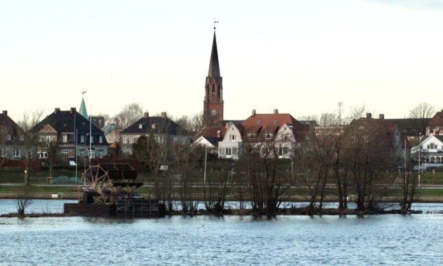
Water levels in the country’s longest river, the Glomma, lake Mjøsa, and lake Øyeren will continue to rise. In Hamar, the water level in Mjøsa is expected to rise by around one meter.
“The water level in Mjøsa is expected to rise by almost one metre. It is slightly below the level of the reference flood we have from 1995, but further down the Øyeren and lower parts of the Glomma the flood may be at the same level as in 1995,” Ivar Berthling at the Norwegian Water Resources and Energy Directorate (NVE) told Public broadcaster NRK.
The flooding in 1995 was the worst seen in the region since 1789. The water in the Øyeren can rise by two metres, making that the most critical situation. However, the peak isn’t expected until Sunday.
Levels at the top of the water courses have begun to fall, but the water from the top flows downwards to the lowest part of the water courses.
“So there we expect that the flood will increase quite a lot in the next few days,” he said.
Water levels in rivers in the Drammensvassdraget, Norway’s third largest watercourse, will continue to rise. However, the forecast there isn’t as bad as initially feared. Only the Tyrifjorden, Sperillen and Randsfjorden lakes are expected to rise.
In Drammen, the emergency manager for the municipality, Sten Petter Aamodt, believes the measures currently in place in the area should be sufficient.
“There is a lot happening in the river now. Keeping some distance, securing one’s values and making sure that nothing more gets into the river, that is the most important call now,” he told NRK on Friday morning.
In Hønefoss, nearly 2,000 people have been evacuated due to flooding. There, the floods will peak on Saturday, with water flow also remaining high throughout the weekend. There are also fears on Hønefoss that erosion caused by flooding could trigger landslides.
Ringerike municipality, the local authority for Hønefoss, has said that it continually assesses the situation and has hotels on standby if more people need evacuation. It is expected that evacuees in Hønefoss will be unable to return home for several days.
In Innlandet county, a red flood danger level applies in Etnedal, Gran, Nord-Aurdal, Nordre Land, Søndre Land, Sør-Aurdal, Vestre Slidre and Øystre Slidre.
Extreme weather and floods have damaged infrastructure such as roads, power grids and water mains, and a landslide risk remains in several places. Those who own cabins in these areas have been asked to postpone trips to their properties.
Travel remains disrupted with rail lines and main roads across southern Norway. Ål, Hol, Nesbyen and Gol in Hallingdal, a valley in southern Norway, have all been hit by flooding or landslides this week.
Member comments