SHARE
COPY LINK

WEATHER

Italy set for hot and muggy Ferragosto weekend with peaks of 38C

After briefly enjoying temperatures in line with seasonal averages, Italy will see the mercury soar again over the Ferragosto long weekend as a new heatwave is set to hit the country.

Tourist in central Rome
A woman waves a handheld fan as she walks across Piazza Navona in central Rome. Photo by Tiziana FABI / AFP

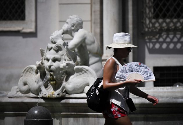
Following a short spell of ‘normal’ summer heat, temperatures in Italy will again rise well above seasonal averages in the coming days as a high-pressure system (or anticyclone) from northern Africa is forecast to reach the country on Friday.

The new heatwave will hit Italy just as thousands of people set out on their Ferragosto getaways, with the August 15th national holiday potentially allowing for a four-day weekend this year.

The incoming ondata di caldo should reach the two major islands, Sicily and Sardinia, first, resulting in daytime temperatures of up to 35C in the former and 37C in the latter on Friday.

READ ALSO: Should you reconsider travel to Italy during a heatwave?

The heat will then move up along the country, reaching southern and central regions by the end of Saturday and northern regions by Sunday.

According to the latest forecasts, Emilia-Romagna, Lombardy, Veneto and Piedmont are all expected to see highs of 36-37C on Sunday, while temperatures in the rest of the country, barring the islands, should hover around the 35C mark. 

Perceived temperatures, however, may ultimately be higher than actual readings as large sections of the country, especially seaside areas and plains, are forecast to see high levels of humidity – a phenomenon known as afa in Italy. 

Tourist cools off in front of fan

A tourist cools off in front of an electric fan before entering Rome’s Colosseum. Photo by Tiziana FABI / AFP

Hot and muggy conditions are expected to continue well into next week, with Tuesday – the day the Ferragosto holiday actually falls on – possibly seeing a further increase in daytime temperatures, according to the latest reports. 

In particular, parts of Tuscany, western Emilia-Romagna, Lombardy and Piedmont may all see temperatures of up to 38C on the day.

READ ALSO: ‘Four to five light meals a day’: Italy’s official advice for surviving the heat

Overall, though temperatures over the Ferragosto break should not match those seen at the height of the July heatwave, people in the country are still advised to take all the necessary precautions to keep cool and stay safe.

Though it’s too early to say exactly how long the latest heatwave will linger over the country, preliminary long-term projections indicate that it may persist until at least Thursday, August 24th. 

Member comments

Log in here to leave a comment.
Become a Member to leave a comment.

WEATHER

IN PICTURES: ‘Exceptional’ Sahara dust cloud hits Europe

An "exceptional" dust cloud from the Sahara is choking parts of Europe, the continent's climate monitor said on Monday, causing poor air quality and coating windows and cars in grime.

IN PICTURES: 'Exceptional' Sahara dust cloud hits Europe

Copernicus Atmosphere Monitoring Service said the latest plume, the third of its kind in recent weeks, was bringing hazy conditions to southern Europe and would sweep northward as far as Scandinavia.

Mark Parrington, senior scientist at Copernicus, said the latest event was related to a weather pattern that has brought warmer weather to parts of Europe in recent days.

“While it is not unusual for Saharan dust plumes to reach Europe, there has been an increase in the intensity and frequency of such episodes in recent years, which could be potentially attributed to changes in atmospheric circulation patterns,” he said.

This latest episode has caused air quality to deteriorate in several countries, Copernicus said.

The European Union’s safe threshold for concentrations of PM10 — coarser particles like sand and dust that that can irritate the nose and throat — has already been exceeded in some locations.

A picture taken on April 8, 2024 shows a rapeseed field under thick sand dust blown in from the Sahara, giving the sky a yellowish appearance near Daillens, western Switzerland. – An “exceptional” dust cloud from the Sahara is choking parts of Europe, the continent’s climate monitor said, causing poor air quality and coating windows and cars in grime. (Photo by Fabrice COFFRINI / AFP)

The worst affected was the Iberian Peninsula in Spain but lesser air pollution spikes were also recorded in parts of Switzerland, France and Germany.

READ ALSO:

Local authorities in southeastern and southern France announced that the air pollution threshold was breached on Saturday.

They advised residents to avoid intense physical activity, particularly those with heart or respiratory problems.

The dust outbreak was expected to reach Sweden, Finland and northwest Russia before ending on Tuesday with a shift in weather patterns, Copernicus said.

The Sahara emits between 60 and 200 million tonnes of fine dust every year, which can travel thousands of kilometres (miles), carried by winds and certain meteorological conditions.

The Spanish Canary Islands off the coast of northwest Africa saw just 12 days within a 90-day period from December to February where skies were free of Saharan dust, the local weather agency Aemet had reported.

SHOW COMMENTS