SHARE
COPY LINK
For members

HIKING

Where are Switzerland’s most dangerous hiking trails?

Hiking is one of favourite summer pastimes for many people in Switzerland, but the country’s hilly and often rugged terrain can be treacherous as well.

Where are Switzerland’s most dangerous hiking trails?
Most Swiss hiking trails are safe. Image by Steven Weirather from Pixabay

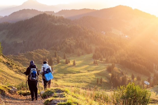
If you are a nature lover, then Switzerland is just perfect for you,

The country has over 65,000 kilometres  of marked trails — “the longest, densest, and most varied network,” according to Switzerland’s Tourist Board. 

Most of the trails are safe, and millions of people walk their length and breadth each year, admiring the stunning scenery, without nary an accident.

But there is also danger afoot — quite literally.

That’s because some trails may seem deceptively easy but can be dangerous if you are not prepared and not aware of the risks.

The Grosser Mythen

The Swiss Alpine Club (SAC) gave the mountain, located in the canton of Schwyz, the unenviable name of “the deadliest route in all of Switzerland.” 

A very popular hiking spot, the mountain has, nevertheless, claimed 22 lives, along with numerous injuries.

Though at an altitude of 1,900 metres, the Grosse Mythen is hardly the tallest mountain in the Swiss Alps, SAC said that some exposed spots along the trail and loose stones that cover the slope can cause serious falls.

Even local tourism authorities have been warning that “the climb is relatively steep and the mountain path is demanding.” 
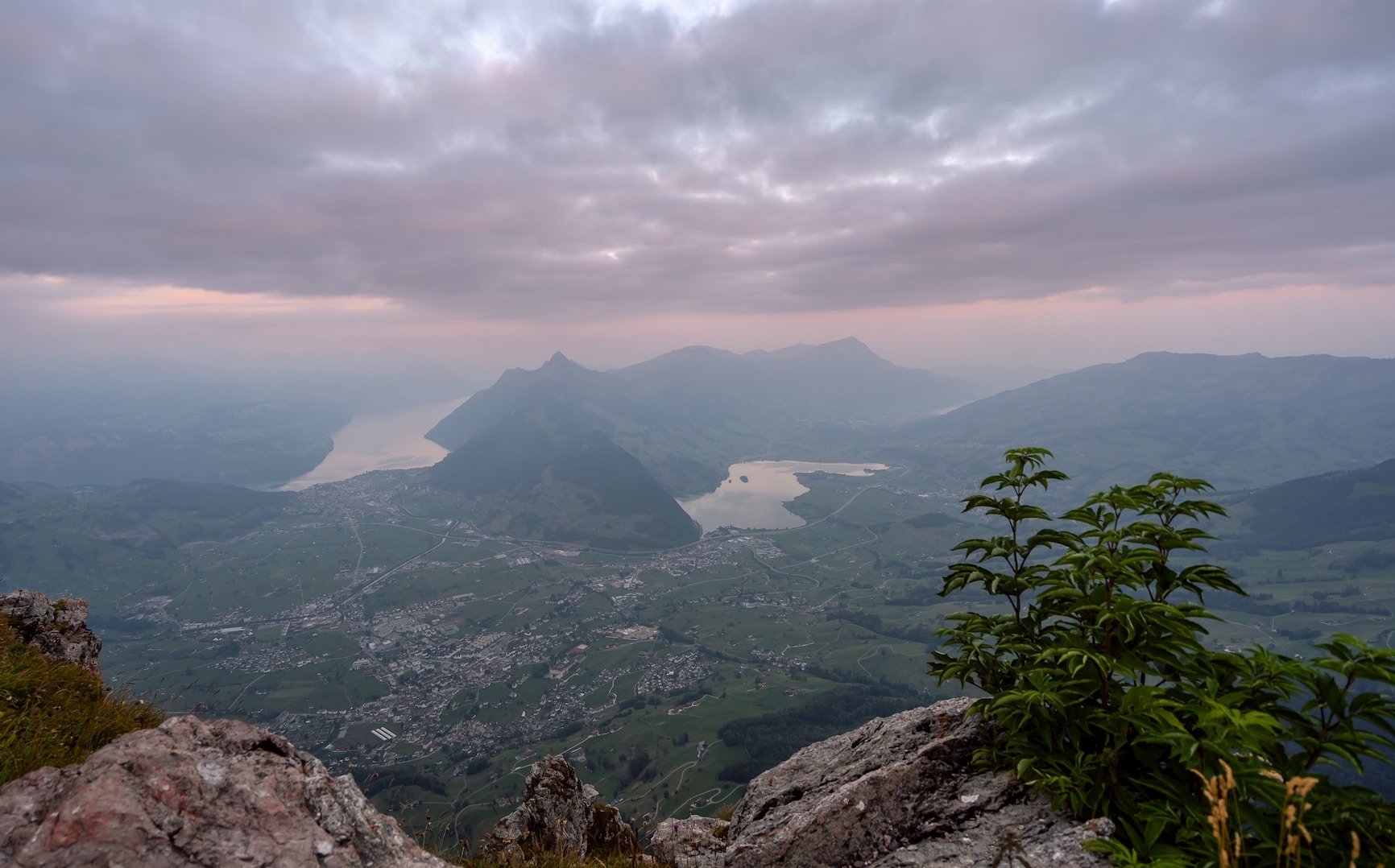
Is this really the ‘deadliest’ mountain in Switzerland? Photo by Pascal Debrunner on Unsplash

The Hardergrat

Of course, ‘danger’ is a subjective term, because what is dangerous for some people may be a piece of cake for others. Much depends on a hiker’s experience, physical condition, and equipment.

While many hikers say the views from the 24-kilometre-long paths located over Interlaken in canton Bern are totally worth the extra effort, others advise caution.

“It is a difficult course, with 3,000 metres of elevation, no shade and no water sources along the way,” according to a  travel magazine.  It takes a lot of effort to complete this hike and it can be dangerous with injuries and fatalities occurring every year.” 

This warning is echoed by a blogger, who wrote that “the Hardergrat trail is considered one the most dangerous trails in the world. It is a physically demanding and technically difficult trail that should only be attempted by experienced mountaineers that accept high risk.”

The Eiger

Climbing up the famous mountain, perched above Grindelwald and Lauterbrunnen in the Bernese Oberland, offers spectacular views that makes the hike up worthwhile to thousands who make the trek.

But many may not know the north face of the mountain is nicknamed  ‘Mordwand,’ which translates to ‘Murder Wall.’
The reason: the wall is known for its falling rocks.

According to one article, this situation is the result of global warming: high summer temperatures are loosening the permafrost that holds the rockface together, leaving climbers at  “severe risk of being injured or killed.” 
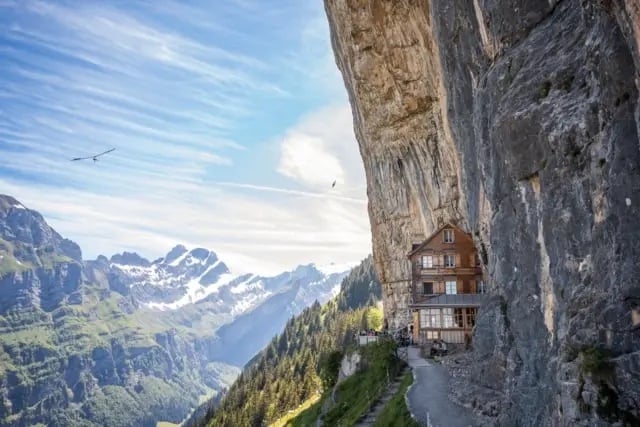
Alpstein

When the Äscher mountain restaurant was featured in the National Geographic  magazine 2015, and subsequently in other international media as well, droves of tourists have hiked to the site, located in an isolated, inaccessible location in the Alpstein region of Appenzell-Ausserrhoden.

They may not have expected the trek to the restaurant to be as difficult as it is; in fact, in 2022 alone, four people died on the trail within a few weeks.

The terrain is notoriously difficult, with narrow paths running alongside steep descents, and many places along the way where hikers can easily stumble and fall.  

The cliff-hanging Äscher mountain restaurant. Photo: The Local

The Pilatus

Overlooking Lucerne in Central Switzerland, Pilatus  very popular with hikers.

However, keep in mind that the hike up Pilatus is very steep, with a rocky and bumpy terrain.

On some sections of the trail, there are chains to which you can (precariously) hold on.
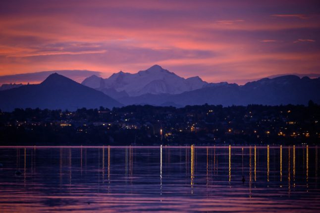
Mont-Blanc

While not located in Switzerland itself, but in France, the Mont-Blanc is nevertheless close enough to Geneva to make it a popular destination for hikers from the area.

It is also dangerous — more so, in fact, that the famous Mt. Everest, which claimed 310 lives since the 1990s..

The death toll on Mont Blanc, however, is significantly higher, even though its altitude is lower than Everest’s.

Some figures cite an average of 100 deaths per year along the Mont Blanc massif, which could stand to rise as climate change increases the risk of rock falls and avalanches.

The majority of deaths on the mountain happen due to falls, people being hit by rocks, or hikers becoming lost or stranded, media have reported.

READ ALSO: Why is climbing Mont Blanc so dangerous?
 
 If you go hiking, be smart

It is important to heed some common-sense advice when heading to the trails:

  • Check the weather to make sure it is hiking-friendly
  • Equip yourself with proper shoes, attire, and other gear
  • Read the Swiss Alpine Club’s guide on how to hike safely.

READ ALSO: How to keep safe and avoid problems when hiking in the Swiss Alps


Member comments

Log in here to leave a comment.
Become a Member to leave a comment.
For members

HIKING

The seven best hikes around Geneva

There are some great one day hikes within easy reach of the Swiss city of Geneva but some are easier than others, writes Monty Pierce Jones.

The seven best hikes around Geneva

When you walk across the Pont du Mont Blanc in the centre of Geneva you notice that you can’t actually see Mont Blanc itself. 

Instead, what catches your eye are a series of smaller, but no less iconic, mountains: Le Salève, Les Voirons, and Le Môle which make up the backdrop of Rive Gauche, and when looking the other way it is impossible to miss the Jura, with Crêt de la Neige and La Dôle being the more eye-catching summits of “Switzerland’s spine”.

These foothills hug the Geneva metropolitan area (forming la cuvette genevoise) – and other than trapping pollution, they offer some brilliant hiking for locals and visitors alike. 

Here are 7 of the best.

Le Salève

The Salève, is known as the balcony of Geneva. The main backdrop of this Swiss city is found in… France, like almost every other hike on this list. It feels like a great limestone wave about to crash onto you: the “French side” builds up slowly to the abrupt cliffs, striations, and quarry of the “Genevois side”. Frankenstein’s monster scales this perpendicular face in Mary Shelley’s book.

I’m not suggesting you follow in Frankenstein’s footsteps exactly, but you too can climb the Salève. Here are two recommended routes:

Via Le Pas de l’Échelle

This four and half hour, 4.4km hike offers an easier walk – but it’s not to be underestimated. Le Pas de l’Échelle is the historic way up the hill, its carved stone step sections attest to its 14th century roots. Park at the Gare de Départ of the Téléphérique (15 minute drive from Geneva’s centre, 40 minutes with a walk if you take the 8 bus) and head towards Chemin du Bois Meriguet. After an hour or so you’ll pass through the lovely village of Monnetier nestled between the Petit and Grand Salève – before reaching the “Panorama”, where you might catch a few paragliders taking off.

Via Chemin de la Grande Gorge

This is a more difficult hike – both longer and steeper than Le Pas de l’Échelle. As the name suggests, it follows the “big gorge” that cuts through this part of the Salève. It winds its way through the couloir before cutting left towards the “Panorama”. It is a more adventurous, secluded climb, and was apparently used by smugglers back in the day. Start from the same spots as Le Pas de l’Échelle.

You can go up one way and down the other to mix things up.

Get more info on trekking La Salève.

Le Signal des Voirons

Le Massif des Voirons (1,480 m) reaches higher than the more dramatic Salève (1,379 m) despite often being overshadowed by it.

This is an injustice, as getting to the top earns you the best 360 degree view on this list. Les Dents du Midi are viewable from the top. It is also wilder than Le Salève, so keep an eye out for orchids, chamois, and if you’re really lucky, a lynx.

Start from the Lac de Machilly parking (30 minutes by car) or the Machilly station (45 minutes by train via Annemasse) and head towards Chemin du Sauget. Turn right on Route du Seujet and you’ll find yourself at the signposted start of the five hour – 17 km loop of Les Voirons.

Le Môle

Le Môle sits further back from the city, but at 1,863 metres (the tallest mountain on this list) it is no molehill. In fact, it has one of the most recognisable silhouettes in the region: a near-perfect pyramid. It too was mentioned by Shelley in Frankenstein.

For an easy, sunny four hour – 9 km hike, drive 40 minutes to Saint-Jean-de-Tholome, park at Chez Beroud, and head towards the summit.

Petit Salève Loop

Park at the Château d’Etrembières (20 minute drive from the centre – can also take the 17 tram and walk). Head towards the forest and walk for around 2 hours hours. You will eventually reach the Camp des Allobroges near the summit. The Allobroges were the Celtic tribe that founded Geneva, they may even have helped Hannibal cross the Alps.

The remnants of their hillfort (or oppidum) – placed there as a symbol of control – are probably the best thing about the hike. The 6km loop should take you about four hours. On the way up you’ll have great views of Geneva and the Jura, and on the way back of Mont Blanc and the Môle.

Chemin de La Dôle

This hike is the only one on this list that is wholly in Switzerland, funnily enough. La Dôle is known for the iconic weather dome that you can easily spot from Le Jardin Anglais.

The views from the summits of the other hikes on this list, as wonderful as they are, do cross-over a fair amount: you can spot Le Môle from Les Voirons and vice versa; they all have great views of Geneva and the Massif du Mont Blanc.

La Dôle offers something different, you get a better sense of l’arc lémanique, and more expansive views of the alps (especially the Bernese and Chablais Alps). It is the furthest out from Geneva, at an hour by train or 45 minutes by car, but it’s worth it.

Le Chemin de La Dôle (SuisseMobile route 116) is a long but easy hike. You will likely walk 15km in 5 hours. You should start in La Givrine and end in St Cergue, though you can keep going to Nyon and in doing so complete the last stage of the Jura Crest Trail (SuisseMobile route 5).

Le Reculet + Crêt de la Neige

This is the hardest hike on this list, if you’re up to it you’ll reach the highest point in the Jura mountains. Le Reculet and Crêt de la Neige don’t jut out much from the Jura range but you can spot them from around the city. Next time you find yourself on one of the stops of the 12 tram in Rive Gauche, look up and you’ll realise that they are often framed by Geneva’s low-rise buildings.

It will take you 40 minutes by car to get to the trailhead (Tiocan, Thoiry), or 1h40 minutes by public transport (50 minutes to Thoiry – take the 18 tram and the 68 bus – and 50 minutes walk). Be prepared for a 13.5 km, 7 hour hike – and a view that encompasses every other peak on this list. It’s worth it.

Further reading:

The websites Monts de Geneve offers more info for treks in the area.

SHOW COMMENTS