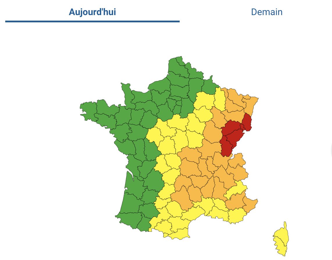
On Tuesday afternoon France’s national weather operator, Météo France, had placed many départements primarily located in the east on the “orange” weather alert for storms.
Later on Tuesday that alert level was raised to red – the highest – in five départements in the east of the country. Those départements were Haute-Saône, Doubs, Jura, Territoire de Belfort and Haut-Rhin.
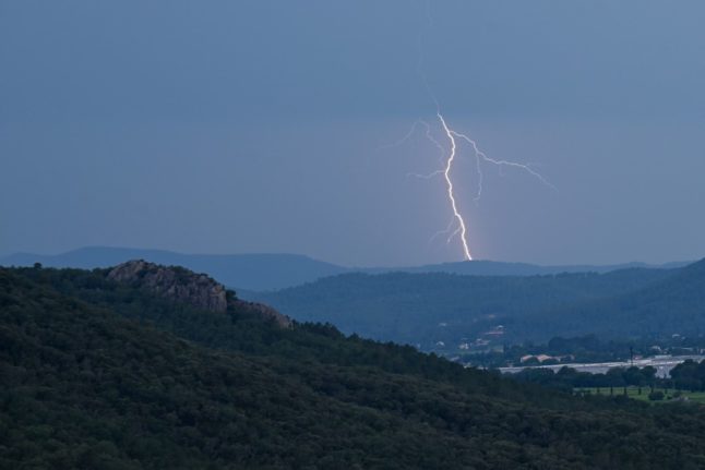
Violent thunderstorms, with hail, heavy rainfall and localised wind gusts of up to 130km per hour were forecast to hit on Tuesday evening.
Some 21 other départements were also on Orange alert for storms.
According to forecaster Météo France red alert level means there is a risk the violent storm could result in falling trees, flash floods and damage to buildings. Members of the public are advised not to travel unless necessary and to seek shelter indoors.
According to Météo France, stormy weather may continue into Wednesday morning in the south-east, but forecasters predict that it will begin to abate in the rest of the country throughout the day.
In response, several cities such as Lyon, Strasbourg and Nancy have announced that public parks would close early in anticipation of the storms.
Train travel has also been affected – as a precaution, France’s national rail service SNCF announced they would be suspending traffic on several routes in the Auvergne-Rhône-Alpes region. Disruption was also expected on some TER lines in Burgundy and Grand Est, according to SNCF.
Pour suivre :
De 16h00 à 19h00 : Ambérieu – Bourg-en-Bresse ; Bourg-en-Bresse – Macon ; Bourg-en-Bresse – Saint-Amour https://t.co/qpyu89VObN— SNCF TER AURA (@SNCFTERAURA) July 11, 2023
An additional nine départements in the south east – Rhône, Ain, Isère, Alpes-Maritimes, Loire, Alpes-des-Haute-Provence, Jura, Côte d’Or, Saône-et-Loire – were still on orange alert for heatwave as well on Tuesday evening.
Temperatures of up to 35C are forecasted to continue in the south-east on Wednesday too.

Member comments