
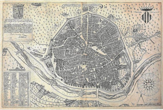
The oldest map of Valencia
Like many big cities in Spain, Valencia has had a long and significant history. Founded in 138 BC by the Romans, Valencia has had various names and has of course grown in size since then. For seven centuries it was part of the Islamic Empire (when it was known as Balansiya) before being united with the rest of Spain as part of the Reconquista in the 13th century.
Much later, Valencia experienced an economic and cultural boom, becoming the centre of the silk trade. The University of Valencia was founded back in 1499, even before the first known map, according to the town hall, which as printed in 1695.
READ ALSO: Seven essential apps that make life in Valencia easier for foreign residents
The city has grown considerably over time
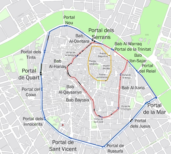
This map shows the approximate location of the old Christian, Arab and Roman walls of the city of Valencia. The line in yellow shows the approximate location of the old Roman walls and the outline of the city that the Romans had called Valentina, because of its bravery. Historians believe it had two main streets and four gates. The place where these two streets crossed is the current Plaza de la Almoina.
During the Arab rule, the city grew and new walls were built, as seen in red. The construction of this wall began in the 11th century. With the fall of the Caliphate of Córdoba, Valencia became the capital of the Taifa of Valencia. The Arab wall surrounded the city and had a total of seven gates. The parts of the wall marked in black are what remains of this wall today.
The Christian wall, marked in blue, made the city bigger still. It was built in 1356 and had a perimeter of four kilometres with a total of 12 gates, four main ones.
READ ALSO: 11 Valencia life hacks that will make you feel like a local
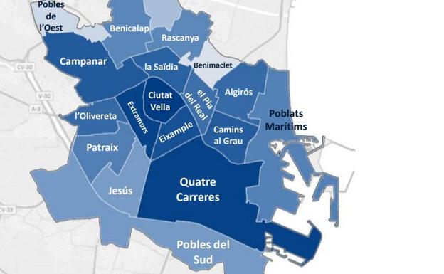
Today, Valencia is made up of 19 different districts
Valencia consists of several different barrios (neighbourhoods) spread out across the city, and is split up into 19 different districts. They are Cuitat Vella, which is the old town; Eixample, Extramurs, Campanar, La Zaidia and El Pla de Real, which we can consider part of the heart of Valencia. Finally, there’s L’Olivereta, Patraix, Jesús, Quatre Carreres, Poblats Maritims (which includes the picturesque coastal barrio El Cabanyal), Camins al Grau, Algirós, Benimaclet, Rascanya, Benicalap, Pobles del Nord, Pobles de l’Oest, and Pobles de Sud, which make up the outer-lying neighbourhoods.

Valencia’s lost river
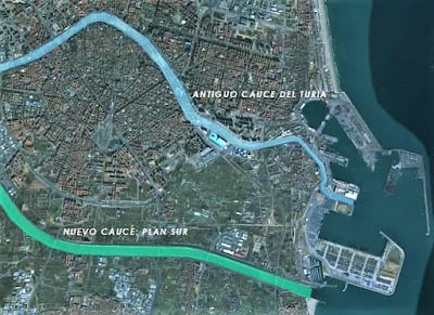
If you’ve ever visited Valencia, you will probably be familiar with the Turia Gardens: the long park that runs around the centre of Valencia, all the way to the coast. This park in fact used to be a river – El Turia.
In 1957, the river burst its banks and flooded large swathes of the city, killing 81 people. Following the flood, the Valencian government decided to reroute the Turia and it was drained and rerouted to avoid the city, as can be seen in this map below.
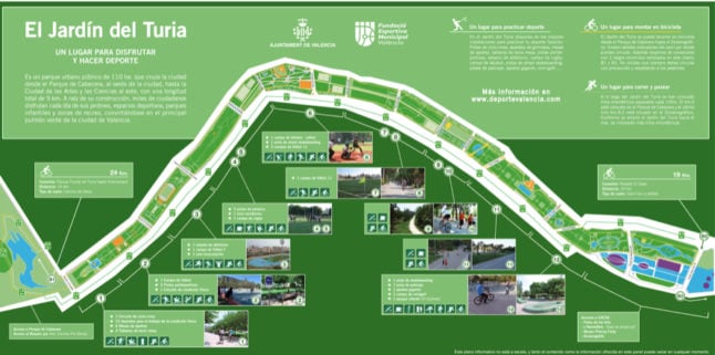
After the river was drained, the dried-out riverbed was used as the location for the city’s main park – El Jardín del Turia (the Turia garden), which is a long, winding park that runs around the old town down towards the coast, via the City of Arts and Sciences.
The park is incredibly popular with runners and cyclists and has several sports pitches spread throughout its long green snake-like space.
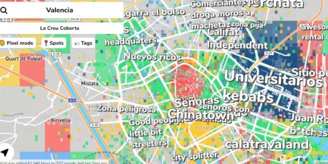
Neighbourhood stereotypes

Member comments