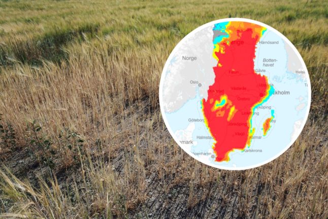
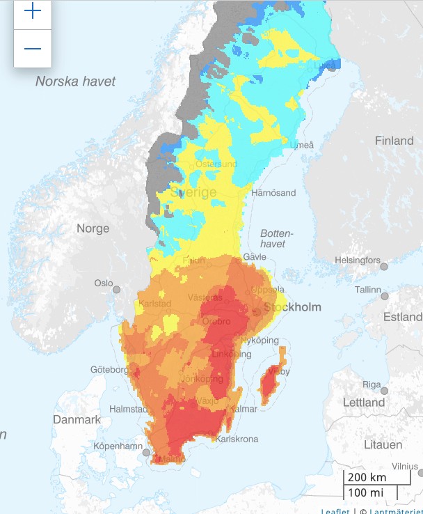
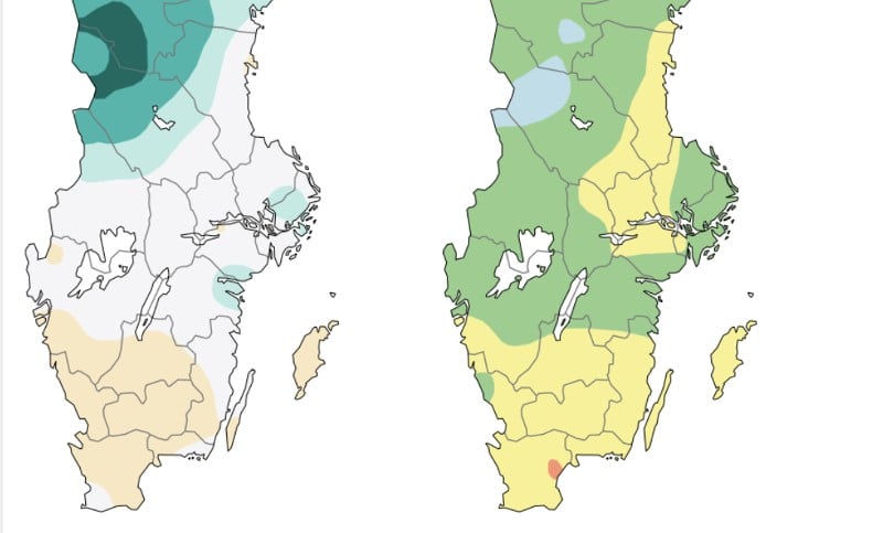
How dry are Sweden’s forests?
On June 8th, almost every part of Sweden south of Gävle was rated as “dry”, “very dry”, or “extremely dry” (yellow, orange, and red) in this map prepared by Sweden’s state-run surveyor Lantmäteriet for the state meteorologist SMHI and the Civil Contingencies Agency (MSB) You can find an interactive map here
This map shows the bränsleuttorkning, or fuel dryness, an estimate of how much, dry burnable leaves and branches are on forest floors in Sweden.
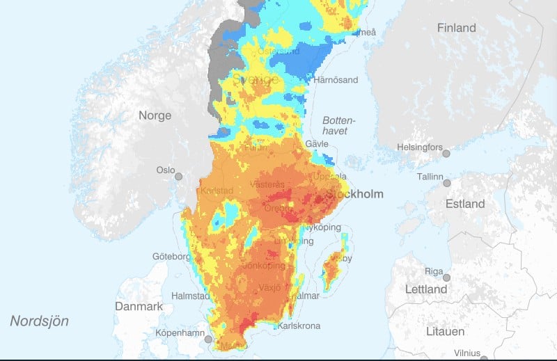
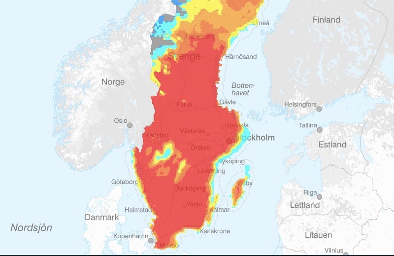
The surveyor also prepares a second map for SMHI and MSB showing the risk of forest fire assessed using the FWI (Fire Weather Index), an index created in Canada which combines measures of air humidity, temperature, 24-hour precipitation and wind speed.
This shows that a lot of areas are already at an “extremely high risk of a forest fire” (red), particularly just south of Västeras, and that large parts of Sweden south of Gävle are at a “very high risk” (dark orange) or “at risk” (orange).
What measures are in place in Sweden?
Municipalities everywhere south of Norrland have already put in place fire bans, or eldförbud, which prevent people from lighting fires or barbecues outside. The only exception is the municipality of Svedala in Skane.

Member comments