SHARE
COPY LINK
For members

FLOODS

EXPLAINED: Why has flooding in northern Italy been so devastating?

After two deadly floods hit Italy’s Emilia Romagna region in just two weeks, why is this area being affected so badly? Here’s what the experts say.

Aerial view of a flooded area in Emilia Romagna
Flooding in Italy's northern Emilia Romagna region on Thursday, May 18th. Photo by Alessandro SERRANO / AFP

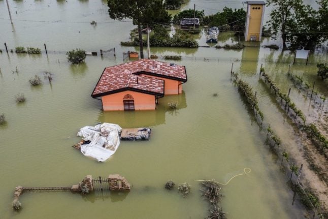
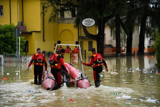
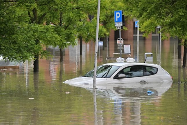
Italy’s northeastern Emilia Romagna region was hit by disastrous flooding on Wednesday and Thursday for the second time in just two weeks following torrential rainfall.

A least 13 people were killed and more than 10,000 evacuated from their homes after rivers across the region burst their banks.

Italy is no stranger to severe floods, but why has the recent flooding in Emilia Romagna been so devastating?  

READ ALSO: ‘Shocking disaster’: Death toll rises to 13 after floods in northern Italy

Firstly, the region was hit by downpours of unprecedented intensity, with up to 50 centimetres of rain, equal to six months’ worth of rainfall, falling in some areas in 36 hours.

According to Francesco Violo, president of Italy’s National Council of Geologists, the recent wave of torrential rain was only the latest in an ever more frequent number of “extreme [weather] events that have a major impact on urban territory”, even in areas of the country where “maintenance is carried out”.

Emergency service staff working in a flooded area in Emilia Romagna

Emergency efforts continued in Emilia Romagna’s flooded areas on Thursday as risk of further flooding remained. Photo by Alessandro SERRANO / AFP

But, though devastating in and of themselves, the consequences of the bomba d’acqua (‘water bomb’ or intense downpour) that pounded the region between Tuesday and Wednesday were further aggravated by other factors. 

READ ALSO: How you can help people affected by flooding in northern Italy

Firstly, the drought that northern Italy, including vast areas of Emilia Romagna, has endured over the last year has greatly reduced the ground’s ability to absorb rain. 

That’s because, in the words of Mauro Rossi, a researcher from the National Research Council (CNR), prolonged drought “dries the soil and modifies its permeability in various ways”, which, coupled with “extreme rain events”, makes “geo-hydrological events more likely in our territory.”

But not only was local soil’s ability to ‘soak up’ rainfall diminished by months of dry weather, the same soil had already been tested in early May by a first round of heavy rains, meaning that some areas were already saturated with water when the latest wave of bad weather came around on Tuesday.

READ ALSO: Floods in Italy: What to do when there’s a weather warning

Car underwater in Emilia Romagna

Entire neighbourhoods in Cesena, Emilia Romagna are currently submerged. Photo by Alessandro SERRANO / AFP

Finally, the absence of water-absorbing vegetation at the sides of many local rivers, including the Lamone – one of Emilia Romagna’s main water courses – contributed to flood waters spreading so rapidly across the region’s flat lands. 

According to Andrea Agapito, head of the Network and Oasis department at WWF, these natural defences and their vital “sponge effect” have been removed over the years to make room for “houses and crop fields”.

Member comments

Log in here to leave a comment.
Become a Member to leave a comment.

WEATHER

IN PICTURES: ‘Exceptional’ Sahara dust cloud hits Europe

An "exceptional" dust cloud from the Sahara is choking parts of Europe, the continent's climate monitor said on Monday, causing poor air quality and coating windows and cars in grime.

IN PICTURES: 'Exceptional' Sahara dust cloud hits Europe

Copernicus Atmosphere Monitoring Service said the latest plume, the third of its kind in recent weeks, was bringing hazy conditions to southern Europe and would sweep northward as far as Scandinavia.

Mark Parrington, senior scientist at Copernicus, said the latest event was related to a weather pattern that has brought warmer weather to parts of Europe in recent days.

“While it is not unusual for Saharan dust plumes to reach Europe, there has been an increase in the intensity and frequency of such episodes in recent years, which could be potentially attributed to changes in atmospheric circulation patterns,” he said.

This latest episode has caused air quality to deteriorate in several countries, Copernicus said.

The European Union’s safe threshold for concentrations of PM10 — coarser particles like sand and dust that that can irritate the nose and throat — has already been exceeded in some locations.

A picture taken on April 8, 2024 shows a rapeseed field under thick sand dust blown in from the Sahara, giving the sky a yellowish appearance near Daillens, western Switzerland. – An “exceptional” dust cloud from the Sahara is choking parts of Europe, the continent’s climate monitor said, causing poor air quality and coating windows and cars in grime. (Photo by Fabrice COFFRINI / AFP)

The worst affected was the Iberian Peninsula in Spain but lesser air pollution spikes were also recorded in parts of Switzerland, France and Germany.

READ ALSO:

Local authorities in southeastern and southern France announced that the air pollution threshold was breached on Saturday.

They advised residents to avoid intense physical activity, particularly those with heart or respiratory problems.

The dust outbreak was expected to reach Sweden, Finland and northwest Russia before ending on Tuesday with a shift in weather patterns, Copernicus said.

The Sahara emits between 60 and 200 million tonnes of fine dust every year, which can travel thousands of kilometres (miles), carried by winds and certain meteorological conditions.

The Spanish Canary Islands off the coast of northwest Africa saw just 12 days within a 90-day period from December to February where skies were free of Saharan dust, the local weather agency Aemet had reported.

SHOW COMMENTS