SHARE
COPY LINK
For members

WEATHER

Italy set for ‘autumn-like’ weekend as bad weather continues

People in Italy are still waiting for summer as most regions expect to see rain and below-average temperatures over the coming days.

Bad weather in Italy
A new cold air front is expected to bring heavy rain and chilly temperatures to many areas of the country over the coming weekend. Photo by Marco BERTORELLO / AFP

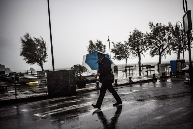
Anyone hoping to spend the coming weekend in the warm, late-spring sunlight may well be disappointed as most regions are forecast to experience more bad weather in the next few days.

After a spell of torrential rain at the beginning of May resulted in deadly flooding in the Emilia-Romagna region, many areas of the country are experiencing wet and unseasonably cool conditions again this week.

Italy’s Department for Civil Protection issued a red weather alert (the highest one available) for southern Emilia-Romagna on Thursday, with new alerts likely to be issued in the coming days.

According to the latest reports, a new cold air front from northern Europe will reach Italy on Friday morning, bringing rain and autumn-like temperatures of between 12 and 18 degrees to most northern and central regions. 

READ ALSO: No more ‘dolce vita’: How extreme weather could change Italian tourism forever

Conditions are currently expected to be particularly intense in the north west of the country (Lombardy, Piedmont, Liguria) and in Tyrrhenian-facing areas, whilst southern regions and the islands, Sicily and Sardinia, should enjoy relatively good weather on the day.

On Saturday, stormy weather and below-average temperatures are expected to persist in the north and centre, with Emilia-Romagna and Marche currently forecast to bear the brunt of the bad weather.

Southern regions are expected to see some rain in the afternoon, though rainfall should be of medium to low intensity in all instances and temperatures should remain around the 20-degree mark. 

Weather will largely improve in the south on Sunday, while it’ll be an unpleasantly wet and cold Festa della Mamma for most people in the north and centre as a new round of cold air currents is set to follow the previous front.

According to the latest reports, Veneto, Friuli Venezia Giulia and northern Emilia-Romagna will be the worst-affected areas, with heavy rain and even some localised hail storms likely during the day. 

At the time of writing, bad weather is expected to spill over into the start of next week, with rain and low temperatures potentially lingering on in some areas of the peninsula until Thursday.

Member comments

Log in here to leave a comment.
Become a Member to leave a comment.

WEATHER

IN PICTURES: ‘Exceptional’ Sahara dust cloud hits Europe

An "exceptional" dust cloud from the Sahara is choking parts of Europe, the continent's climate monitor said on Monday, causing poor air quality and coating windows and cars in grime.

IN PICTURES: 'Exceptional' Sahara dust cloud hits Europe

Copernicus Atmosphere Monitoring Service said the latest plume, the third of its kind in recent weeks, was bringing hazy conditions to southern Europe and would sweep northward as far as Scandinavia.

Mark Parrington, senior scientist at Copernicus, said the latest event was related to a weather pattern that has brought warmer weather to parts of Europe in recent days.

“While it is not unusual for Saharan dust plumes to reach Europe, there has been an increase in the intensity and frequency of such episodes in recent years, which could be potentially attributed to changes in atmospheric circulation patterns,” he said.

This latest episode has caused air quality to deteriorate in several countries, Copernicus said.

The European Union’s safe threshold for concentrations of PM10 — coarser particles like sand and dust that that can irritate the nose and throat — has already been exceeded in some locations.

A picture taken on April 8, 2024 shows a rapeseed field under thick sand dust blown in from the Sahara, giving the sky a yellowish appearance near Daillens, western Switzerland. – An “exceptional” dust cloud from the Sahara is choking parts of Europe, the continent’s climate monitor said, causing poor air quality and coating windows and cars in grime. (Photo by Fabrice COFFRINI / AFP)

The worst affected was the Iberian Peninsula in Spain but lesser air pollution spikes were also recorded in parts of Switzerland, France and Germany.

READ ALSO:

Local authorities in southeastern and southern France announced that the air pollution threshold was breached on Saturday.

They advised residents to avoid intense physical activity, particularly those with heart or respiratory problems.

The dust outbreak was expected to reach Sweden, Finland and northwest Russia before ending on Tuesday with a shift in weather patterns, Copernicus said.

The Sahara emits between 60 and 200 million tonnes of fine dust every year, which can travel thousands of kilometres (miles), carried by winds and certain meteorological conditions.

The Spanish Canary Islands off the coast of northwest Africa saw just 12 days within a 90-day period from December to February where skies were free of Saharan dust, the local weather agency Aemet had reported.

SHOW COMMENTS