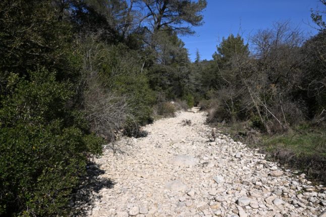
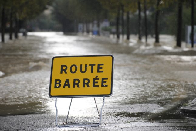
Many of France’s water tables are below normal levels and more than half the country is on some level of drought alert, despite rainfall in some parts of the country over the summer, as of early autumn in France.
In a mid-September interview with French daily Libération, French environment minister Christophe Béchu said that 189 communes – home to a total of 40,000 people – were still without drinking water.
READ MORE: September 2023 to be France’s hottest September ever
Some areas have been under alert since spring, and it is expected that more water restrictions will be imposed over the coming weeks.
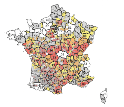
In France, water restrictions are done by municipality and there are four levels.
Level 1 – vigilence (grey on the map below). The first step is issuing a drought warning. This doesn’t bring in any restrictions, but lets residents know that there is a risk of drought and restrictions could be introduced soon.
Level 2 – alert (yellow on the map). The lowest level of alert mainly concerns farmers, who must reduce their water usage by 50 percent. Watering of public green spaces such as golf courses is restricted and for households there are limits on car washing, while gardens can only be watered at certain times (usually evening).
Level 3 – alert renforcée (orange). Further restrictions on agricultural water usage and a total ban on household activities such as car-washing and watering lawns or flower beds (watering of vegetable gardens is still permitted during certain hours).
Level 4 – crise (red). Ban on all non-priority water usage. Households can use water for drinking, cooking and washing. Communes at the crise level can impose other restrictions if the situation requires it – up to and including limiting the amount of water households can use per day. In extreme cases where the water runs out totally, local mairies are responsible for distributing drinking water to households.
As of August 28th, 53 départements had issued a crise level warning.
You can check to see if your area is under water restrictions by going to the French government website vigieau.gouv.fr and typing in your home or rental address. The website will inform you of what (if any) restrictions are in place, as well as offering government advice for how to decrease your water usage.
Otherwise, you can consult the public map on the government site “Propluvia“, which is updated daily.
The exact details of restrictions for each area is outlined by the mairie, so if your area is on any level of alert, you can find more details via the mairie.
Local authorities also have the power to impose extra restrictions if necessary – for example the mayor of Grasse imposed higher water charges during the summer, as a water-saving incentive.
Even areas that are not currently on alert are encouraged – although not required – to save water, with the government unveiling a national water-saving plan.
READ ALSO Hosepipe bans, pools and 4-minute showers – how France’s water restrictions work
More drought warnings and water restrictions could continue to be announced, even in the autumn, and you can check the latest updates on the map here.
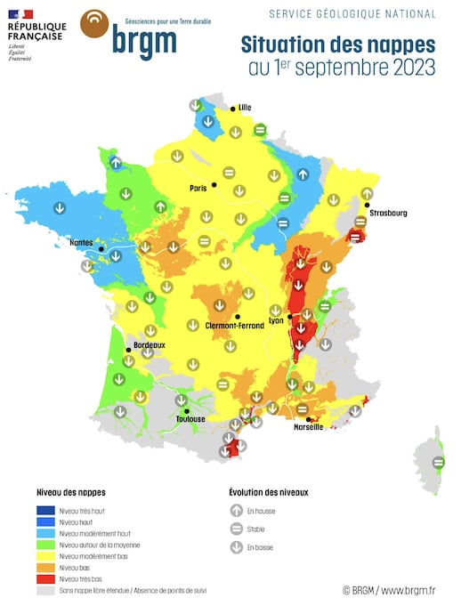
The national geological service released an update regarding the state of the country’s underground water tables, as of September 1st, which serves as an indicator of which areas are at particular risk for drought.
Locations in green and blue were considered to have average to above average underground water levels. Much of the country was coloured yellow for “moderately low”, while some locations were coloured orange (“low”) and red (“very low”).
Member comments