SHARE
COPY LINK

WEATHER

Austria hit by record snowfall – and there’s more to come

Snow levels nationwide are at an almost ten-year high, with parts of Carinthia affected by power outages and up to 30 centimeters of snow in Burgenland as well as a thick coating in Vienna.

Skier in snow
There's heavy snow in eight of Austria's nine regions today. Photo: Christof Stache/AFP

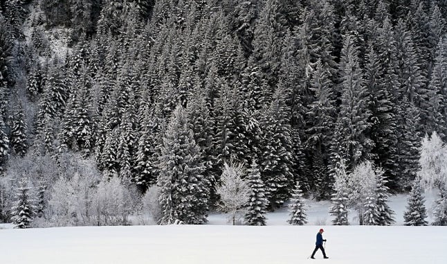
Residents in the east and south east of Austria have woken up to the heaviest snowfall in nine years – with more forecast into the afternoon of Thursday, December 9th.

In Burgenland, up to 30 centimeters of snow fell overnight on Wednesday and power outages are impacting several hundred homes in Carinthia in the districts of St. Veit an der Glan, Spittal an der Drau and Villach-Land after nearly 40 centimetres of snow fell.

In the mountains, 20 to 40 centimeters of snow are reported to have fallen and, according to international weather service Ubimet, 50 to 60 centimeters of snow has already fallen in Vorarlberg, East Tyrol and Carinthia.

READ MORE: Where to find international food in Austria this Christmas

Even the capital city of Vienna has several centimeters of snow with many public transport routes delayed on Thursday morning.

Austriaโ€™s Centre for Severe Weather has issued its highest alerts for Vorarlberg, Tyrol and Carinthia and snow clearing vehicles have been out in force to keep roads in operation.

The Kronen Zeitung reports emergency services have been kept busy with cars stuck in snow, fallen trees and pedestrians falling on slippery streets.

FOR MEMBERS: How will skiing look in Austria this winter?

More snow is forecast across the country on Thursday, especially in the east and south east, while snowfall is expected to ease in the west in the afternoon.

Upper Austria is the only part of the country where heavy snowfall is not forecast. The western areas of the Danube and Linz have reportedly had a light coating of snow and up to 10 centimeters is expected in the province.

Looking ahead to the weekend, most parts of the country should have some sunshine on Friday morning, while snow could persist in the west. By the evening, snow could return to Upper Austria, Salzburg and East Tyrol.

According to Bergfex, more snow is forecast in the Alps on Saturday and Sunday, while in the east and south east it should be dry and sunny.

Do you have photos of the snow in your part of Austria? Share them with The Local and we will publish the best images. Please upload a photo using the form below, or send an email to us at [email protected].

Member comments

Log in here to leave a comment.
Become a Member to leave a comment.

WEATHER

IN PICTURES: ‘Exceptional’ Sahara dust cloud hits Europe

An "exceptional" dust cloud from the Sahara is choking parts of Europe, the continent's climate monitor said on Monday, causing poor air quality and coating windows and cars in grime.

IN PICTURES: 'Exceptional' Sahara dust cloud hits Europe

Copernicus Atmosphere Monitoring Service said the latest plume, the third of its kind in recent weeks, was bringing hazy conditions to southern Europe and would sweep northward as far as Scandinavia.

Mark Parrington, senior scientist at Copernicus, said the latest event was related to a weather pattern that has brought warmer weather to parts of Europe in recent days.

“While it is not unusual for Saharan dust plumes to reach Europe, there has been an increase in the intensity and frequency of such episodes in recent years, which could be potentially attributed to changes in atmospheric circulation patterns,” he said.

This latest episode has caused air quality to deteriorate in several countries, Copernicus said.

The European Union’s safe threshold for concentrations of PM10 — coarser particles like sand and dust that that can irritate the nose and throat — has already been exceeded in some locations.

A picture taken on April 8, 2024 shows a rapeseed field under thick sand dust blown in from the Sahara, giving the sky a yellowish appearance near Daillens, western Switzerland. – An “exceptional” dust cloud from the Sahara is choking parts of Europe, the continent’s climate monitor said, causing poor air quality and coating windows and cars in grime. (Photo by Fabrice COFFRINI / AFP)

The worst affected was the Iberian Peninsula in Spain but lesser air pollution spikes were also recorded in parts of Switzerland, France and Germany.

READ ALSO:

Local authorities in southeastern and southern France announced that the air pollution threshold was breached on Saturday.

They advised residents to avoid intense physical activity, particularly those with heart or respiratory problems.

The dust outbreak was expected to reach Sweden, Finland and northwest Russia before ending on Tuesday with a shift in weather patterns, Copernicus said.

The Sahara emits between 60 and 200 million tonnes of fine dust every year, which can travel thousands of kilometres (miles), carried by winds and certain meteorological conditions.

The Spanish Canary Islands off the coast of northwest Africa saw just 12 days within a 90-day period from December to February where skies were free of Saharan dust, the local weather agency Aemet had reported.

SHOW COMMENTS