After an unusually cool and damp July and August, France has been basking in temperatures up to 31C over the past week.
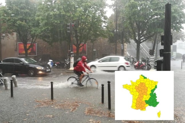
However Wednesday sees 32 départements, roughly a third of the country, placed on alert for thunderstorms with torrential rain, the possibility of localised flooding and hail in some areas.
🔶 32 dpts en #vigilanceOrange
Restez informés sur https://t.co/rJ24zzmmy4 pic.twitter.com/mrCIM8XUi0
— VigiMétéoFrance (@VigiMeteoFrance) September 8, 2021
The storms are predicted to hit on Wednesday afternoon and evening in the départements of Essonne, Hauts-de-Seine, Seine-Saint-Denis, Val-de-Marne, Val-d’Oise, Allier, Aude, Ariège, Aveyron, Cher, Corrèze, Creuse, Dordogne, Eure-et-Loir, Haute-Garonne, Gers, Indre, Indre-et-Loire, Loir-et-Cher, Loiret, Lot, Lot-et-Garonne, Nièvre, Hautes-Pyrénées, Sarthe, Paris, Seine-et-Marne, Yvelines, Tarn, Tarn-et-Garonne, Haute-Vienne and Yonne.
French weather forecaster Météo France is predicting very heavy rain in a short time (40 to 60 mm in three to four hours), as well as hail in places and strong gusts of wind (80 to 100 km/h).
The heaviest rainfall is expected in the northern part of the Aude département and southern Tarn, where 100 to 120mm of rain could fall in three hours.

Member comments