SHARE
COPY LINK

WEATHER

WEATHER ALERT: Snow warning issued for Stockholm and Uppsala

Sweden's weather forecaster has issued a snow warning for Stockholm and Uppsala, with the regions around the two cities expected to get between 5 and 15 centimetres of snowfall on Monday.

WEATHER ALERT: Snow warning issued for Stockholm and Uppsala
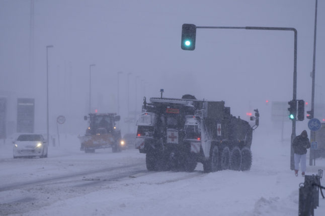
Sweden's weather forecaster SMHI said it was unclear whether the snow would settle, as it did last week. Photo: Anders Wiklund/TT

“Above all, it's in Uppland where we expect the largest amounts to come,” Petter Lind, a meteorologist with SMHI, told the TT newswire about the region that's home to the university town of Uppsala.

Between 5 and 15 centimetres of snow is forecast for the coast region north of Uppsala, while around Stockholm, there will be around 5 centimetres snow, with SMHI saying it was “uncertain how much would stay on the ground”.

With temperatures expected to hover up and down around freezing point throughout the day, the snowfall is expected to lead to icy roads, accidents and traffic problems.

READ ALSO: 

SMHI also expects about 10 centimetres of snow on the Roslagen coast north of Stockholm, and about 5 centimetres of snow on the island of Gotland.

“The temperature won't change that much over the day, but might creep up a bit around the coast. It's going to be pretty close to zero, but in the evening it might drop and get colder,” Lind said.

Unlike earlier this month ago, when heavy blizzards left much of Sweden covered with deep snow, the snowfall is expected to end after one day, with sunshine expected on Tuesday.

Member comments

Log in here to leave a comment.
Become a Member to leave a comment.

WEATHER

Denmark records deepest snow level for 13 years

Blizzards in Denmark this week have resulted in the greatest depth of snow measured in the country for 13 years.

Denmark records deepest snow level for 13 years

A half-metre of snow, measured at Hald near East Jutland town Randers, is the deepest to have occurred in Denmark since January 2011, national meteorological agency DMI said.

The measurement was taken by the weather agency at 8am on Thursday.

Around 20-30 centimetres of snow was on the ground across most of northern and eastern Jutland by Thursday, as blizzards peaked resulting in significant disruptions to traffic and transport.

A much greater volume of snow fell in 2011, however, when over 100 centimetres fell on Baltic Sea island Bornholm during a post-Christmas blizzard, which saw as much as 135 centimetres on Bornholm at the end of December 2010.

READ ALSO: Denmark’s January storms could be fourth extreme weather event in three months

With snowfall at its heaviest for over a decade, Wednesday saw a new rainfall record. The 59 millimetres which fell at Svendborg on the island of Funen was the most for a January day in Denmark since 1886. Some 9 weather stations across Funen and Bornholm measured over 50cm of rain.

DMI said that the severe weather now looks to have peaked.

“We do not expect any more weather records to be set in the next 24 hours. But we are looking at some very cold upcoming days,” DMI meteorologist and press spokesperson Herdis Damberg told news wire Ritzau.

SHOW COMMENTS