SHARE
COPY LINK

CLIMATE

EXPLAINED: Why warm winters are especially bad for Switzerland

The weather has been unseasonably warm throughout the country lately, with temperatures this Sunday reaching over 21 degrees in some parts of Switzerland. But as enjoyable as this springlike weather may be, it is a bad sign for the future, experts warn.

EXPLAINED: Why warm winters are especially bad for Switzerland
Swiss glaciers, like there Gorner Ridge above Zermatt. Photo by FABRICE COFFRINI / AFP

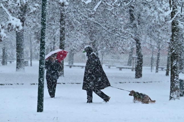
The climate as we know it in the Northern Hemisphere —warm summers and cold winters —  is changing.

What causes warmer winters?

Blame the Arctic weather pattern that scientists believe is trapping cold air in the polar region, stopping it from flowing south. Unfortunately, this phenomenon could become ‘the new normal’ as global warming increases in pace.

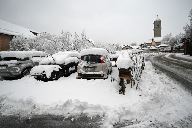
What kind of changes are taking place in Switzerland because of the warmer climate?

According to climate expert Julien Perrot, unseasonable temperatures are disrupting the natural cycle: the dandelions are starting to come out of the ground, the crocuses are open, the snakes are out and about when they should still be in hibernatation, and the amphibians have started their migration towards the marshes.

If the warm-winter trend continues, various species could become weaker and change their behavioural patterns in order to adapt. That is not the evolutionary path that nature intended.

Why is this bad?

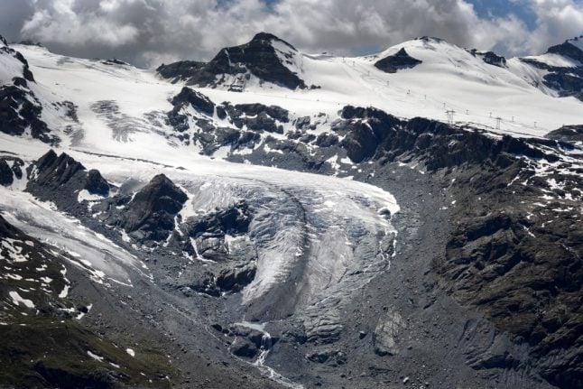
We can expect far-reaching and devastating consequences of warmer winters, such as glaciers continuing to melt at an alarming rate. Lakes, including those in Switzerland are warming faster than the surrounding environment.

As ice melts, more water flows into Alpine lakes, eroding the coastline and increasing the risk of flooding.

According to a document issued by the Swiss Agency for Development and Cooperation (SDC), “we are seeing changes in the number and size of lakes which are related to global warming”. 

The report goes on to say that “the retreat of glaciers is one of the most dramatic signs of global warming and has a major impact on security and how millions of people live their lives”.

READ ALSO: Swiss glaciers shrink ten percent in five years

The situation was especially bad after last summer’s heatwaves

During two weeks of intense heat at the end of June and again in late July, the volume of snow and ice melting on Swiss glaciers … was equivalent to the country’s total annual consumption of drinking water.

A special commission at the Swiss Academy of Sciences said: “This means that, over the past 12 months, around two percent of Switzerland’s total glacier volume has been lost,” the commission said, adding that the rate of loss over the past five years “exceeds 10 percent.”

That marks “a rate of decline never previously observed in the time series extending back for more than a century,” it said.

Aside from melting glaciers, are Alps in any other danger due to warmer weather?

Yes, increasing temperatures are causing massive rock slides in the mountains because the permafrost layers which used to be permanently frozen are now melting. This is happening throughout the Alps, including in the Matterhorn and the Eiger.

When nature is out of whack, as it is now, “it’s hard not to be a catastrophist”, Perrot said.

“We have potentially entered a disaster phase and we have to wake up urgently”, he added.

READ MORE: Swiss cities enjoy record sunny January, but what’s next for winter? 

Member comments

Log in here to leave a comment.
Become a Member to leave a comment.

CLIMATE

Central and southern Italy brace for storms and heavy snow

Storms and snowfall are forecast across much of central and southern Italy over the next few days, according to weather reports.

Snow is forecast in the hills of much of central and southern Italy.
Snow is forecast in the hills of much of central and southern Italy. Photo: Miguel MEDINA / AFP

Italy’s Civil Protection Department on Monday issued ‘orange’ alerts for bad weather along Campania’s Tyrrhenian coastline and the western part of Calabria, while Sicily, Basilicata, Lazio, Molise, Umbria, Abruzzo, central-western Sardinia, and the remaining areas of Campania and Calabria are under a lower-level ‘yellow’ weather warning.

The European Centre for Medium-Range Weather Forecasts is warning Italy’s central-southern regions to prepare for a blast of polar air from the Arctic Circle that will bring heavy snowfall, rain and storms, reports national weather forecaster Il Meteo.

The village of Grotte di Castro in the province of Viterbo, two hours’ drive north of Rome, mountainous parts of Sardinia, and much of the province of Campobasso in the central-eastern region of Molise were already blanketed in snow on Monday morning.

The department is responsible for predicting, preventing and managing emergency events across the country, and uses a green, yellow, orange and red graded colour coding system for weather safety reports.

An orange alert signifies a heavy rainfall, landslide and flood risk, while a yellow alert warns of localised heavy and potentially dangerous rainfall.

The current meteorological conditions mean that snow is expected to reach unusually low altitudes of around 450-500 metres, with flakes already falling thickly on parts of the southern-central Apennines mountain range at 500-700 metres altitude.

The hills of Marche, Abruzzo, Molise, Lazio, Sardinia, Campania, Calabria and Basilicata are likely to see heavy snow around the 500m mark, while areas at an altitude of 1000m or higher will see between 50-60 cm of fresh snow.

Affected parts of the country could see 50-60cm of snowfall.

Affected parts of the country could see 50-60cm of snowfall. Photo: Vincenzo PINTO /AFP

In areas where the snow is unlikely to reach, heavy rains and thunderstorms are anticipated, with rain forecast throughout Sardinia, Campania, Calabria and Lazio, reports Il Meteo.

Strong winds are forecast over the whole country, with the island regions of Sicily and Sardinia facing windspeeds of over 100km/hour and the risk of storm surges, according to the national newspaper La Repubblica.

READ ALSO: Climate crisis: The Italian cities worst affected by flooding and heatwaves

The north of the country, meanwhile, will see sun but low temperatures of below 0°C at night in many areas, including across much of the Po Valley.

While conditions are expected to stabilise on Tuesday, cold currents from Northern Europe are forecast to trigger another wave of bad weather on Wednesday and Thursday, with Sardinia and Italy’s western coastline again at risk of storms and heavy rainfall that will move up towards Lombardy, Emilia Romagna and Veneto in the north.

SHOW COMMENTS