SHARE
COPY LINK

POLLUTION

MAP: How to check the air pollution levels near you in France

The French government has launched an interactive map that tells people in real time about the levels of air pollution near their home.

MAP: How to check the air pollution levels near you in France
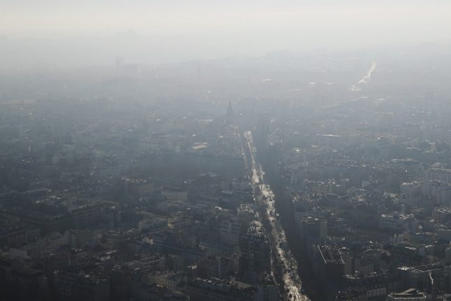
Paris with a blanket of smog. Photo: AFP

The air quality maps, which cover the whole of mainland France, show information on the levels of ozone, nitrogen dioxide (NO2) and suspended particulate matter (PM 10 and PM 2.5) in the air that we breathe.

Run by the Prev'Air system operated by the Ministry of the Environment, the maps show air quality levels on that day, as well as offering a forecast for the following day.

READ ALSO

Map: Prev'Air

There are thirteen air quality control bodies in France and the map links to the different areas, which offer colour-coded ratings of the air quality from good to medium and poor.

Air quality has been a particular problem for Paris, with the city regularly breaching targets for safe levels of air pollution.

On Tuesday, Paris declared a 'climate emergency' following in the footsteps of cities including New York, Brussels and London.

“Paris, like other cities, declares a climate emergency,” Celia Blauel, deputy mayor in charge of the environment, told a municipal council meeting, stressing the need to adhere to the objectives of the 2015 Paris Climate Accord.

The declaration also said Paris city hall would create a “climate academy” with the aim of better educating the young and the public about the issue.

Last month the French state lost a court case brought by a mother and daughter who said the high level of air pollution around the Paris ringroad caused them both health problems.

To access the map, click here.


Member comments

Log in here to leave a comment.
Become a Member to leave a comment.

POLLUTION

Greenpeace sounds alarm over Spain’s ‘poisonous mega farms’

The “uncontrolled” growth of industrial farming of livestock and poultry in Spain is causing water pollution from nitrates to soar, Greenpeace warned in a new report on Thursday.

Greenpeace sounds alarm over Spain's 'poisonous mega farms'
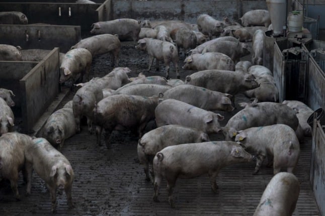
Pollution from hundreds of intensive pig farms played a major role in the collapse of Murcia Mar Menor saltwater lagoon. Photo: JOSEP LAGO / AFP

The number of farm animals raised in Spain has jumped by more than a third since 2015 to around 560 million in 2020, it said in the report entitled “Mega farms, poison for rural Spain”.

This “excessive and uncontrolled expansion of industrial animal farming” has had a “serious impact on water pollution from nitrates”, it said.

Three-quarters of Spain’s water tables have seen pollution from nitrates increase between 2016 and 2019, the report said citing Spanish government figures.

Nearly 29 percent of the country’s water tables had more than the amount of nitrate considered safe for drinking, according to a survey carried out by Greenpeace across Spain between April and September.

The environmental group said the government was not doing enough.

It pointed out that the amount of land deemed an “area vulnerable to nitrates” has risen to 12 million hectares in 2021, or 24 percent of Spain’s land mass, from around eight million hectares a decade ago, yet industrial farming has continued to grow.

“It is paradoxical to declare more and more areas vulnerable to nitrates”, but at the same time allow a “disproportionate rise” in the number of livestock on farms, Greenpeace said.

Pollution from hundreds of intensive pig farms played a major role in the collapse of one of Europe’s largest saltwater lagoons, the Mar Menor in Spain’s southeast, according to a media investigation published earlier this week.

Scientists blamed decades of nitrate-laden runoffs for triggering vast blooms of algae that had depleted the water of the lagoon of oxygen, leaving fish suffocating underwater.

Two environmental groups submitted a formal complaint in early October to the European Union over Spain’s failure to protect the lagoon.

SHOW COMMENTS