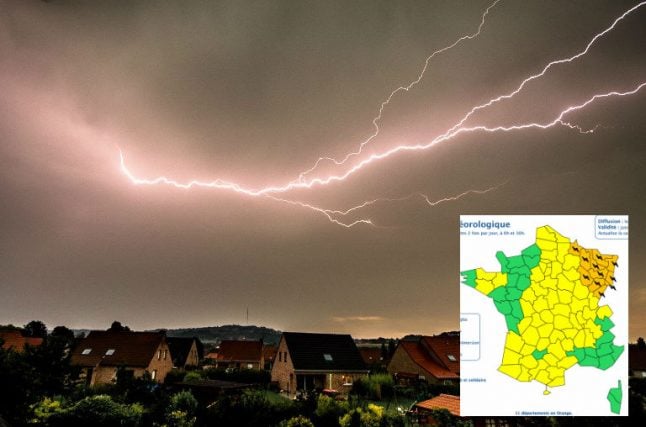
A total of 11 departments in the north east of France have been placed on orange alert – the second highest warning – for violent storms by France's national weather agency Meteo France.
The departments concerned are: Ardennes, Doubs, Haute-Marne, Meurthe-et-Moselle, Meuse, Moselle, Bas-Rhin, Haut-Rhin, Haute-Saône, Vosges and Territoire-de-Belfort.
People in these areas are advised to remain vigilant due to the risk of dangerous weather.
The storm alerts were put in place at 10am on Wednesday morning and are expected to remain in place until at least 6am on Thursday.
 Photo: Meteo France
According to Meteo France, the storms will “start in the Franche-Comté region before heading up north and reaching the Grand Est region, which is on orange alert..
Very impressive photo of a #shelfcloud with green interior over #Paris, France a little while ago this afternoon 4th of June! Photo by Bertrand Kulik @ptrenard https://t.co/f50t0hv7F6 #severeweather #Orages #thunderstorm pic.twitter.com/qC6UAJp8CK
— WEATHER/ METEO WORLD (@StormchaserUKEU) June 4, 2019
The storms led to delays on certain train lines as trees fell onto the tracks (see below) and play was stopped Roland-Garros where the French Open is currently taking place.
#Orages : de fortes rafales de #vent (93 km/h à St-Cyr-l'École, 105 km/h au sommet de la Tour Eiffel) peuvent provoquer des chutes d'arbres, comme à #Paris & en #IledeFrance (image Mickaël Haton à Nanterre). Trafic Transilien & RER ralenti ou interrompu sur certaines lignes. @LCI pic.twitter.com/H2DhxknaMt
— Guillaume Woznica (@GWoznica) June 4, 2019
Rain defeats brand-new Roland-Garros centre court Chatrier! Upper tier front row seats a river of water with bottles and cans floating along after downpour stops Nadal-Nishikori. Fans have to sit with their feet in several inches of water or with their legs in the air. Oh dear pic.twitter.com/PqPknIl0n9
— Rory Mulholland (@mulhollandrory) June 4, 2019
Member comments