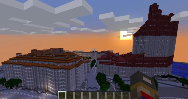
In an effort to get local kids interested in urban planning, Gothenburg's city planning department has painstakingly recreated all 10 districts of Sweden's second city in the popular game and released them. Unlike some other user created models, this one is built on the city's real geographic data, with everything from houses to roads and even small details like trees represented.
In total, 400 square kilometres of the game’s digital one metre squared cubes have been used to create the model. Users can visit famous landmarks like the Lipstick Building (läppstiftet), or walk across the bridges over the Göta canal at Brunnsparken and Gustaf Adolfs torg. And they should be able to recognize it all from real life, albeit in a more pixilated form.
Gustaf Adolfs torg. Photo: Göteborgs Stad
A Christmas competition has even been included where a treasure chest has been hidden in a landmark in each of the 10 districts. The first person to find all 10 by January 8th has a chance to win a prize.
READ ALSO: Virtual Sweden recreated in Minecraft
“Ultimately we see Minecraft as an arena where we can work together with schools and specific groups during the early stages of planning an area in order to get multiple perspectives on urban planning,” City of Gothenburg city planning director Agneta Hammar explained in a press release.
The 10 districts as well as instructions (in Swedish) can be downloaded here. Users are also being encouraged to upload screenshots of their finds to Instagram with the hashtag #minecraftgbg.