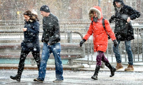
Forecasters said on Monday afternoon that temperatures in southern Sweden would remain a few degrees below zero in the next few days. Parts of the region – including Stockholm – experienced light snowfall after midday and meteorologists predicted that heavier dumps were likely on Saturday and Sunday.
“Before the end of the week, there might at first be a bit of milder air, especially in the southern parts of the country, then we have a low pressure from the southwest bringing in more continuous snowfall,” Marie Staerk, a meteorologist at Swedish weather agency SMHI told the TT news agency.
Meanwhile, thermometers in northern Norrland were set to record -30C this week as the New Year cold snap continues. Staerk said that residents there should get to experience plenty more of the white stuff, with the coldest weather set to reach the mountainous Härjedalen region and Lapland, where strong winds are also expected.
“When it's windy it can feel a lot colder,” Staerk added, warning winter sport enthusiasts to wrap up warm and take extra safety precautions if they venture outdoors.
“Many are in the mountains and skiing, and must be prepared that it might be colder than the temperature indicates because of the cooling effect,” she said.
The latest spell of snowy weather in Sweden contrasts with an unusually warm December in many parts of the country.
Gävle, in northern Sweden, set new records for high December temperatures twice in two weeks and the Swedish capital experienced only a brief dusting of snow in the run-up to Christmas.


 Please whitelist us to continue reading.