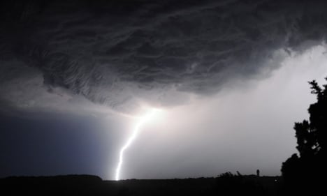
SHARE
COPY LINK

WEATHER

Storm warnings spread across western France

France's national weather agency has issued further weather warnings as thunderstorms approach the country from the west.

Storm warnings spread across western France
Thunder, lightning, and hail are forecast to hit north-western France on Wednesday night. Photo: AFP
France's weather agency Météo France issued an “orange warning” for a further 12 départements in France in its 4pm bulletin on Wednesday. These take the total number of départements on alert to 19.
 
The reason? Thunder and hail storms are approaching from the west. 
 
The agency warned that there would be lightning, strong winds, and enough rain to cause potential flash flooding in people's cellars. It warned residents to avoid taking shelter under trees, and to avoid using the telephone or electrical appliances. 
 

(Photo: AFP)
 
An Orange warning is the second highest warning level and asks the public to be “very vigilant”.
 
The areas since the morning are Finistère, Côtes-d'Armor, Ille-et-Vilaine, Manche, Calvados, Orne, and Mayenne – all in the north and north west of France. Météo France added Seine-Maritime, Eure, and Sarthe to this list in the afternoon.
 
It also added Charente, Charente-Maritime, Dordogne, Gironde, Landes, Lot-et-Garonne, Pyrénées-Atlantiques, Gers, and Hautes-Pyrénées – all in the south west of France. See map below.
 

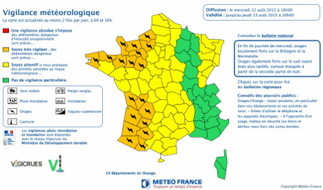
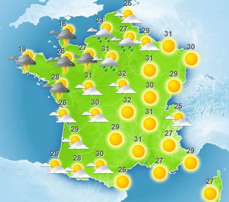
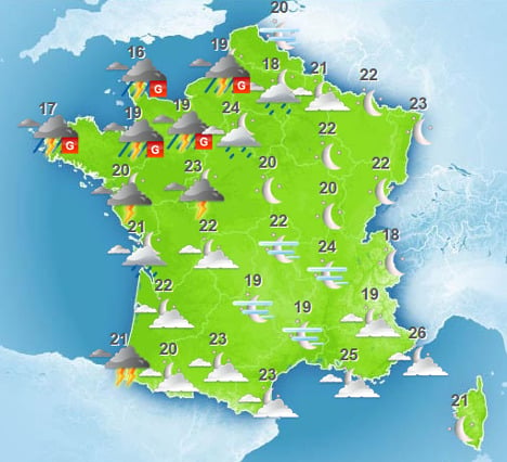
The storm will hit in the late afternoon and early evening, while the majority of the rest of France will be enjoying a late warm and sunny night (see map below).

By late evening, however, the hail storms are forecast to hit, marked by the letter G in the map below. These storms will remain throughout most of the night and into the early morning, gradually spreading south along France's Atlantic coast. 

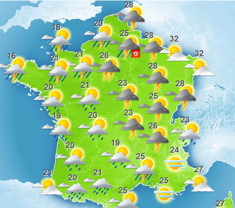
And it's bad news for the rest of the country on Thursday, as the storms will push towards the east throughout the day. The map below shows France in the early evening on Thursday. 


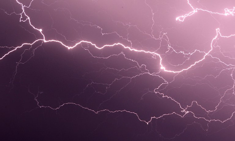
(All photos and maps: Météo France)

The weather forecast is also bad news for stargazers, with Wednesday night said to be the best opportunity to see this year's Perseid meteor shower (if only the weather remains clear).

If you're in a part of France without clouds, here are some tips to catch what's been dubbed as one of the best celestial events in years.


Member comments

Log in here to leave a comment.
Become a Member to leave a comment.

WEATHER

Denmark records deepest snow level for 13 years

Blizzards in Denmark this week have resulted in the greatest depth of snow measured in the country for 13 years.

Denmark records deepest snow level for 13 years

A half-metre of snow, measured at Hald near East Jutland town Randers, is the deepest to have occurred in Denmark since January 2011, national meteorological agency DMI said.

The measurement was taken by the weather agency at 8am on Thursday.

Around 20-30 centimetres of snow was on the ground across most of northern and eastern Jutland by Thursday, as blizzards peaked resulting in significant disruptions to traffic and transport.

A much greater volume of snow fell in 2011, however, when over 100 centimetres fell on Baltic Sea island Bornholm during a post-Christmas blizzard, which saw as much as 135 centimetres on Bornholm at the end of December 2010.

READ ALSO: Denmark’s January storms could be fourth extreme weather event in three months

With snowfall at its heaviest for over a decade, Wednesday saw a new rainfall record. The 59 millimetres which fell at Svendborg on the island of Funen was the most for a January day in Denmark since 1886. Some 9 weather stations across Funen and Bornholm measured over 50cm of rain.

DMI said that the severe weather now looks to have peaked.

“We do not expect any more weather records to be set in the next 24 hours. But we are looking at some very cold upcoming days,” DMI meteorologist and press spokesperson Herdis Damberg told news wire Ritzau.

SHOW COMMENTS