SHARE
COPY LINK

WEATHER

Renewed heavy snow strikes Lake Geneva area

More snow is forecast for Switzerland on Tuesday following accumulations that snarled transport in the Lake Geneva region on Monday, disrupting flights at Genevaโ€™s airport and causing headaches for commuters.

Renewed heavy snow strikes Lake Geneva area
Snow at Geneva's botanical garden. Photo: MeteoSwiss/Dean Gill

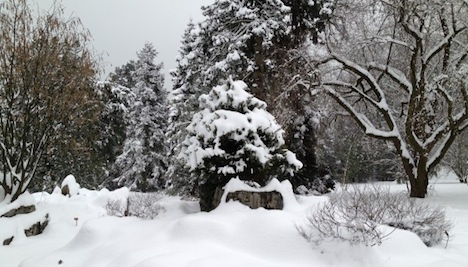
Around 20 centimetres fell on the Geneva area on Monday morning as a relatively warm, moist weather system collided with cold air, MeteoSwiss, the national weather office said.

Geneva airport opened an hour later than usual at 7pm but closed half an hour later because of the heavy snow accumulation, the ATS news agency reported.

Planes starting taking off and landing at 10.15am — with some delays — after 40 flights were cancelled, the airport said.

In Geneva buses and trams were unable to operate normally on many routes, forcing some commuters to walk into work.

Luckily, the volume of traffic was reduced because of February school holidays which began in Geneva on Monday.

The Tribune de Genève reported on line that almost 2,500 homes lost power Monday night in an area between Thônex and Jussy after a branch weighed down by snow fell on an 18,000-volt transmission line.

Electricity was restored to most homes by 9pm.

In the canton of Vaud, cantonal police reported around 25 motor vehicle accidents involving significant damage on snow-covered roads.

In Lausanne, bus service on some routes was suspended during the morning because ploughs were unable to clear the roads quickly enough.

MeteoSwiss said it expected a further 10 to 15 centimetres of snow early Tuesday in the Lake Geneva area.

Snow is forecast across the Alps and the Alpine foothills.

The weather service issued a level three (orange) warning for heavy snowfall from Geneva to areas north of Neuchâtel in the Jura and Fribourg, as well as the Vaud Alps.

The snow follows a period of extreme cold in parts of Switzerland on the weekend.

Glattalp in the canton of Schwyz recorded a temperature of minus 36 degrees on Sunday morning, a record for so far this winter.

Member comments

Log in here to leave a comment.
Become a Member to leave a comment.

WEATHER

IN PICTURES: ‘Exceptional’ Sahara dust cloud hits Europe

An "exceptional" dust cloud from the Sahara is choking parts of Europe, the continent's climate monitor said on Monday, causing poor air quality and coating windows and cars in grime.

IN PICTURES: 'Exceptional' Sahara dust cloud hits Europe

Copernicus Atmosphere Monitoring Service said the latest plume, the third of its kind in recent weeks, was bringing hazy conditions to southern Europe and would sweep northward as far as Scandinavia.

Mark Parrington, senior scientist at Copernicus, said the latest event was related to a weather pattern that has brought warmer weather to parts of Europe in recent days.

“While it is not unusual for Saharan dust plumes to reach Europe, there has been an increase in the intensity and frequency of such episodes in recent years, which could be potentially attributed to changes in atmospheric circulation patterns,” he said.

This latest episode has caused air quality to deteriorate in several countries, Copernicus said.

The European Union’s safe threshold for concentrations of PM10 — coarser particles like sand and dust that that can irritate the nose and throat — has already been exceeded in some locations.

A picture taken on April 8, 2024 shows a rapeseed field under thick sand dust blown in from the Sahara, giving the sky a yellowish appearance near Daillens, western Switzerland. – An “exceptional” dust cloud from the Sahara is choking parts of Europe, the continent’s climate monitor said, causing poor air quality and coating windows and cars in grime. (Photo by Fabrice COFFRINI / AFP)

The worst affected was the Iberian Peninsula in Spain but lesser air pollution spikes were also recorded in parts of Switzerland, France and Germany.

READ ALSO:

Local authorities in southeastern and southern France announced that the air pollution threshold was breached on Saturday.

They advised residents to avoid intense physical activity, particularly those with heart or respiratory problems.

The dust outbreak was expected to reach Sweden, Finland and northwest Russia before ending on Tuesday with a shift in weather patterns, Copernicus said.

The Sahara emits between 60 and 200 million tonnes of fine dust every year, which can travel thousands of kilometres (miles), carried by winds and certain meteorological conditions.

The Spanish Canary Islands off the coast of northwest Africa saw just 12 days within a 90-day period from December to February where skies were free of Saharan dust, the local weather agency Aemet had reported.

SHOW COMMENTS