SHARE
COPY LINK

WEATHER

Deep freeze set to hold for several weeks

The icy temperatures which have swept across Sweden in recent days are set to persist for a couple of weeks, according to latest forecasts.

Deep freeze set to hold for several weeks

Monday recorded the coldest night of the winter, with the residents of Vajmat in northern Lappland experiencing temperatures as low as -42.6 degrees Celsius, according to a Swedish Transport Administration (Trafikverket) measurement.

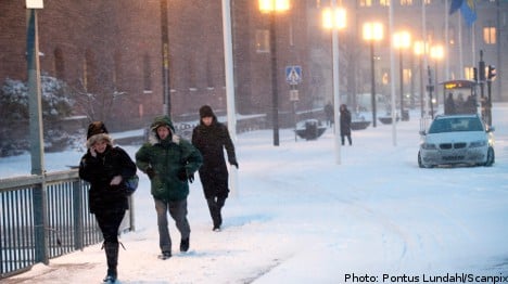
The icy temperatures were not limited to the far north however, with as low as minus 28 degrees Celsius in Tullinge in southern Stockholm in the early hours of Monday.

In the midst of some of the coldest temperatures of the winter, some 450 customers of electricity utility Vattenfall were left without power on Monday night.

The customers in Jokkmokk in the far north of the country lost their power just as temperatures outside fell to below -40.

“It probably got a little cold, it is minus 40 there. But no injuries have been reported, most people use wood stoves to warm up,” said Peter Stedt at Vattanefall.

According to meteorological agency SMHI the cold snap is set to keep the country in its frosty grasp for at least a couple of weeks.

Cloudy weather in southern areas will keep temperatures close to zero on Wednesday, but further north the dial is expected to plunge to around 25 degrees Celsius and lower.

In return many northern areas will experience clear, sunny weather in the remainder of the week as the high pressure front establishes itself across the country.

Over the weekend and into next week, SMHI forecast that the cloud cover will break up in the south of the country, bringing with it colder temperatures.

Member comments

Log in here to leave a comment.
Become a Member to leave a comment.

WEATHER

Denmark records deepest snow level for 13 years

Blizzards in Denmark this week have resulted in the greatest depth of snow measured in the country for 13 years.

Denmark records deepest snow level for 13 years

A half-metre of snow, measured at Hald near East Jutland town Randers, is the deepest to have occurred in Denmark since January 2011, national meteorological agency DMI said.

The measurement was taken by the weather agency at 8am on Thursday.

Around 20-30 centimetres of snow was on the ground across most of northern and eastern Jutland by Thursday, as blizzards peaked resulting in significant disruptions to traffic and transport.

A much greater volume of snow fell in 2011, however, when over 100 centimetres fell on Baltic Sea island Bornholm during a post-Christmas blizzard, which saw as much as 135 centimetres on Bornholm at the end of December 2010.

READ ALSO: Denmark’s January storms could be fourth extreme weather event in three months

With snowfall at its heaviest for over a decade, Wednesday saw a new rainfall record. The 59 millimetres which fell at Svendborg on the island of Funen was the most for a January day in Denmark since 1886. Some 9 weather stations across Funen and Bornholm measured over 50cm of rain.

DMI said that the severe weather now looks to have peaked.

“We do not expect any more weather records to be set in the next 24 hours. But we are looking at some very cold upcoming days,” DMI meteorologist and press spokesperson Herdis Damberg told news wire Ritzau.

SHOW COMMENTS