SHARE
COPY LINK
For members

WEATHER

What’s next after Switzerland’s ‘extremely worrying’ heatwave?

Switzerland hit record high temperatures for June for the first time in 75 years on Sunday but what's the forecast for the coming days and weeks?

A boy jumps into Lake Geneva at sunset from a platform off the village of Lutry, western Switzerland on August 9th 2020.
A boy jumps into Lake Geneva at sunset from a platform off the village of Lutry, western Switzerland on August 9th 2020. Switzerland is seeing severely hot weather this week. (Photo by Fabrice COFFRINI / AFP)

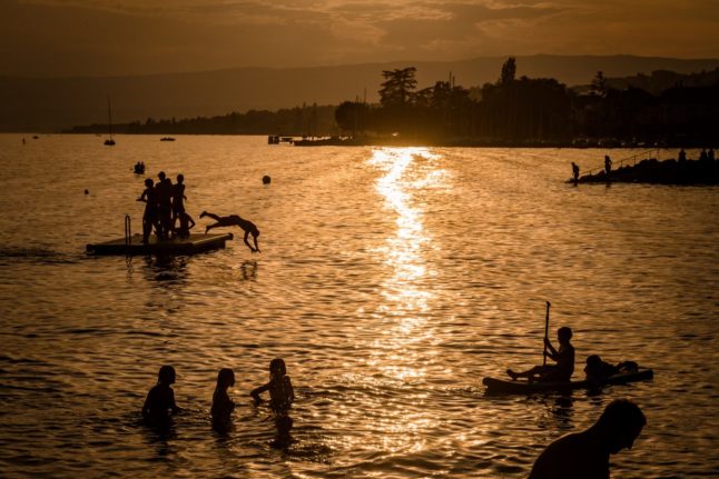
With 36.9C recorded in Beznau, in the canton of Aargau on Sunday, Switzerland equalled the high temperature record held by Basel since 1947.

Other Swiss towns experienced sweltering temperatures as well: In Neuchâtel the mercury rose to 36.5C, in Sion it hit 36.4C and  in Lausanne it was 32.6C, according to MeteoNews.

Temperatures were decidedly more pleasant at high altitudes in the mountains: the temperature of 16.9C was recorded at 2,900 metres in the shade on the Diablerets glacier.

Whilst lower down at the Moléson in Fribourg, which stands at 2,000 metres, a more seasonal 24 degrees was recorded.

Like its neighbours, “Switzerland is not immune to brief and extreme phenomena”, climatologist Martin Beniston, honorary professor at the University of Geneva, said in an interview with Tribune de Genève.

And if high temperatures continue — as they are forecast for next days — “the very dry ground will reinforce the warming, it is a vicious circle”, said Vincent Devantay, meteorologist from MeteoNews.

This means higher risk of fires, especially in the forest. “They have really dried up compared to last year. The lack of rain is becoming extremely worrying”, he pointed out.

Thunderstorms are predicted in parts of Switzerland towards the end of the week but they will not necessarily prevent the drought, Beniston said.

What the soil needs are “gentle showers, repeated, for two to three weeks”, rather than occasional heavy thunderstorms that don’t provide enough moisture for the earth’s deeper layers.

Continued rains are not expected in the immediate future and  forecasts for the summer months predict more intense heatwaves.

READ MORE: How this week’s heatwave will hit Switzerland and how to stay cool

What are the consequences of the heatwave and no rain?

As The Local already reported, Swiss glaciers are now melting faster than usual, partly due to the early heat wave in May.
 
READ MORE: Why Switzerland’s glaciers are melting faster than usual this summer

But there is more.

Hydrologist Massimiliano Zappa, also warns that current very high temperatures and no rain could speed up the drought across Switzerland, especially as Swiss rivers and streams “have a lower flow than the average of previous years”.

Water rationing could become inevitable, he said.

 “In Spain and southern Italy, for example, people know how to get by with little water, because they have been educated to meet their daily needs with less. But this is not part of Swiss mentality”, Zappa said.

The heat wave could also impact railway installations as well as electronic devices, according to Le Temps newspaper.

“Overheated smartphones, expanding rails, and computer fans running at full speed: high temperatures put a strain on infrastructure and our everyday objects, while requiring more energy”, Le Temps said.
 

Member comments

Log in here to leave a comment.
Become a Member to leave a comment.

WEATHER

IN PICTURES: ‘Exceptional’ Sahara dust cloud hits Europe

An "exceptional" dust cloud from the Sahara is choking parts of Europe, the continent's climate monitor said on Monday, causing poor air quality and coating windows and cars in grime.

IN PICTURES: 'Exceptional' Sahara dust cloud hits Europe

Copernicus Atmosphere Monitoring Service said the latest plume, the third of its kind in recent weeks, was bringing hazy conditions to southern Europe and would sweep northward as far as Scandinavia.

Mark Parrington, senior scientist at Copernicus, said the latest event was related to a weather pattern that has brought warmer weather to parts of Europe in recent days.

“While it is not unusual for Saharan dust plumes to reach Europe, there has been an increase in the intensity and frequency of such episodes in recent years, which could be potentially attributed to changes in atmospheric circulation patterns,” he said.

This latest episode has caused air quality to deteriorate in several countries, Copernicus said.

The European Union’s safe threshold for concentrations of PM10 — coarser particles like sand and dust that that can irritate the nose and throat — has already been exceeded in some locations.

A picture taken on April 8, 2024 shows a rapeseed field under thick sand dust blown in from the Sahara, giving the sky a yellowish appearance near Daillens, western Switzerland. – An “exceptional” dust cloud from the Sahara is choking parts of Europe, the continent’s climate monitor said, causing poor air quality and coating windows and cars in grime. (Photo by Fabrice COFFRINI / AFP)

The worst affected was the Iberian Peninsula in Spain but lesser air pollution spikes were also recorded in parts of Switzerland, France and Germany.

READ ALSO:

Local authorities in southeastern and southern France announced that the air pollution threshold was breached on Saturday.

They advised residents to avoid intense physical activity, particularly those with heart or respiratory problems.

The dust outbreak was expected to reach Sweden, Finland and northwest Russia before ending on Tuesday with a shift in weather patterns, Copernicus said.

The Sahara emits between 60 and 200 million tonnes of fine dust every year, which can travel thousands of kilometres (miles), carried by winds and certain meteorological conditions.

The Spanish Canary Islands off the coast of northwest Africa saw just 12 days within a 90-day period from December to February where skies were free of Saharan dust, the local weather agency Aemet had reported.

SHOW COMMENTS