Swiss federal weather forecasters have predicted heavy storms for much of central and southern Switzerland from Monday lunchtime onwards.
Forecasters have predicted a severity of 3 out of a possible 4. The strongest storms are predicted from 1pm to 6pm.
The following tweet shows where the heaviest storms are forecast.
Warnung des Bundes: heftige Gewitter möglich. Gefahrenstufe 3 (von 4). Betroffene Regionen, weitere Informationen und Verhaltensempfehlungen auf https://t.co/qjoYMzvqsA oder auf der MeteoSwissApp. #MeteoSchweiz #Unwetterwarnung pic.twitter.com/q90gQtFLtg
— MeteoSchweiz (@meteoschweiz) July 26, 2021
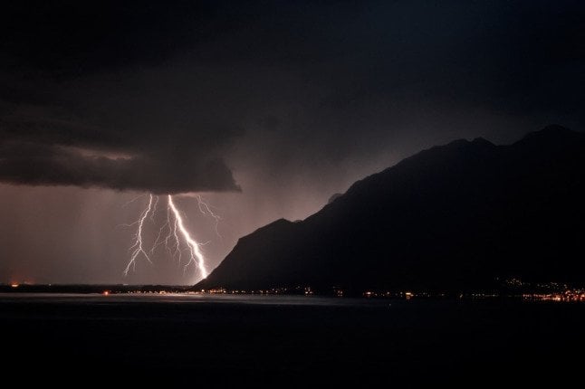
Thunderstorms and heavy rains raged across Switzerland, and about 30,000 lightning bolts hit overnight from Saturday to Sunday.
Some areas, including central Switzerland and Ticino, were particularly impacted, flooding basements, blocking roads, and disrupting rail traffic. However, no one was hurt.
In Appenzell, over 33.2 millimeters of rain fell in 10 minutes on Saturday evening — the largest accumulations of precipitation ever measured in such a short time in Switzerland.
In Appenzell Ausserrhoden, large hail stones were dumped on several localities.
Aufgrund von Starkregen und #Hagel wähnte man sich in Appenzell #Ausserrhoden am Nachmittag im tiefsten Winter. https://t.co/l62Rt1WYoq
— SRF News (@srfnews) July 24, 2021
READ MORE: Floods: Why was Switzerland impacted less severely than Germany?
What is the forecast for this week?
“We have survived the worst for now,” said Stefan Scherrer, meteorologist at MeteoNews.
After Monday’s storms, individual showers or thunderstorms may continue sporadically for the remainder of the week, “but they will not be severe”.
For the next few days, Scherrer predicts changeable weather.
Der Alpenraum liegt auch heute Montag in einer feuchtwarmen Südwestströmung. Als Folge ist es veränderlich mit einem Mix aus #Wolken, #Sonne und vor allem am Nachmittag #Schauern und stellenweise kräftigen #Gewittern. Prognosen: https://t.co/2lv0pkxXAz (ss) pic.twitter.com/8ehFGl9PAG
— MeteoNews (@MeteoNewsAG) July 26, 2021
The sun will peek through the clouds occasionally, interspersing with rain thunderstorms, he said.
Overall, the situation is not expected to be as dire as it had been in the past 10 days, with Swiss lakes and rivers swelling, bursting their banks and flooding nearby areas.
The level of lakes and rivers has fallen to near-normal or normal levels.
READ MORE: Weather update: Lake Zurich bursts banks, Lucerne preparing for flooding


Member comments