SHARE
COPY LINK

WEATHER

Heavy thunderstorms to return in Switzerland from Friday

After a brief period of sunny weather, storms and rain are expected to return to Switzerland from Friday. With more than 100 litres forecast in some regions, we broke down why this rain could be more dangerous than most rain storms. 

Heavy thunderstorms to return in Switzerland from Friday
A photo of the Gornergrat, in Zermatt, Switzerland. Photo by Alain Rieder on Unsplash

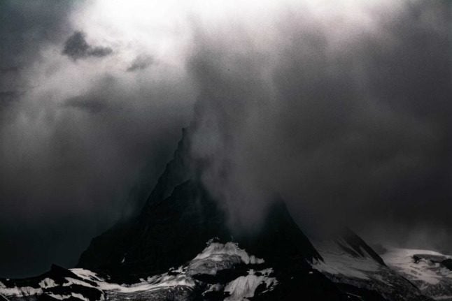
Despite the still swollen rivers and lakes, the sun is currently shining across most of Switzerland. 

High-pressure system Dana has brought sunny skies and warmer weather to much of the country after last week’s heavy rainfall due to low pressure system Bernd. 

Unfortunately things will take another turn for the worse this weekend, with heavy rains and thunderstorms again predicted for Switzerland. 

Meteorological agency Meteonews has forecast over 100 litres of rain for the weekend. 

While this is less rain than much of Switzerland received last weekend, it is problematic as the soil is already sodden and cannot absorb much more water. 

Floods: Why was Switzerland impacted less severely than Germany?

Rivers and lakes are also close to capacity across the country, meaning a little extra water could make a big impact. 

Between 20 and 100 litres are predicted for much of central Switzerland, with up to 120 litres predicted in the south of the country. 

“It’s going to be turbulent,” Roger Perret from Meteonews told 20 Minutes. 

Perret said he didn’t expect the weather to last longer than the weekend, as high winds from the mountains was likely to push it along. 

However, Switzerland can expect unpredictable weather conditions for the coming weeks, Perret said. 

You can stay on top of the situation as it keeps evolving through this link.

Stay away from lakes and rivers

Despite ideal weather for swimming this week, experts warn that many lakes and rivers remain dangerous.

It will take several weeks of dry weather for the waterways to descend to their normal levels, according to the Federal Office for the Environment.

READ MORE: Weather update: Lake Zurich bursts banks, Lucerne preparing for flooding

Member comments

Log in here to leave a comment.
Become a Member to leave a comment.

WEATHER

IN PICTURES: ‘Exceptional’ Sahara dust cloud hits Europe

An "exceptional" dust cloud from the Sahara is choking parts of Europe, the continent's climate monitor said on Monday, causing poor air quality and coating windows and cars in grime.

IN PICTURES: 'Exceptional' Sahara dust cloud hits Europe

Copernicus Atmosphere Monitoring Service said the latest plume, the third of its kind in recent weeks, was bringing hazy conditions to southern Europe and would sweep northward as far as Scandinavia.

Mark Parrington, senior scientist at Copernicus, said the latest event was related to a weather pattern that has brought warmer weather to parts of Europe in recent days.

“While it is not unusual for Saharan dust plumes to reach Europe, there has been an increase in the intensity and frequency of such episodes in recent years, which could be potentially attributed to changes in atmospheric circulation patterns,” he said.

This latest episode has caused air quality to deteriorate in several countries, Copernicus said.

The European Union’s safe threshold for concentrations of PM10 — coarser particles like sand and dust that that can irritate the nose and throat — has already been exceeded in some locations.

A picture taken on April 8, 2024 shows a rapeseed field under thick sand dust blown in from the Sahara, giving the sky a yellowish appearance near Daillens, western Switzerland. – An “exceptional” dust cloud from the Sahara is choking parts of Europe, the continent’s climate monitor said, causing poor air quality and coating windows and cars in grime. (Photo by Fabrice COFFRINI / AFP)

The worst affected was the Iberian Peninsula in Spain but lesser air pollution spikes were also recorded in parts of Switzerland, France and Germany.

READ ALSO:

Local authorities in southeastern and southern France announced that the air pollution threshold was breached on Saturday.

They advised residents to avoid intense physical activity, particularly those with heart or respiratory problems.

The dust outbreak was expected to reach Sweden, Finland and northwest Russia before ending on Tuesday with a shift in weather patterns, Copernicus said.

The Sahara emits between 60 and 200 million tonnes of fine dust every year, which can travel thousands of kilometres (miles), carried by winds and certain meteorological conditions.

The Spanish Canary Islands off the coast of northwest Africa saw just 12 days within a 90-day period from December to February where skies were free of Saharan dust, the local weather agency Aemet had reported.

SHOW COMMENTS