
Es fängt an zu quellen über Deutschland und die ersten #Gewitter haben sich auch schon entwickelt. Am Nachmittag droht vor allem in der Westhälfte lokal #Platzregen und #Hagel um 2 cm. Seid wachsam und informiert euch unter https://t.co/c0actryFJD oder in der WarnWetter-App. V pic.twitter.com/FRMGnaYLLP
— DWD (@DWD_presse) June 3, 2021
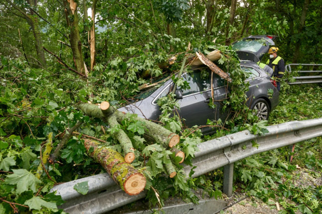


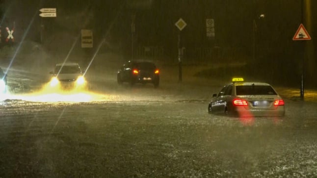
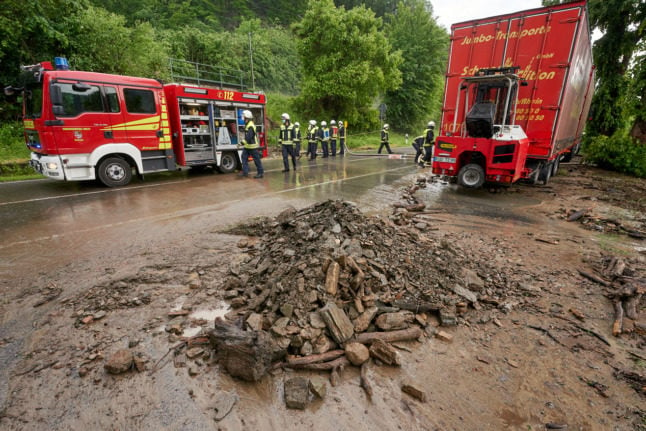
Photo: picture alliance/dpa | Thomas Frey
While residents of Hessen, Rhineland-Palatinate and North Rhine-Westphalia battled against thunderstorms and gale-force winds, other parts of Germany enjoyed clear skies and summery temperatures. In the southwestern state of Baden-Württemberg, temperatures hit highs of around 28C on Thursday, while in Berlin and Brandenburg, they peaked at around 27C around midday.

Will the storms stretch into Friday?
According to the DWD, another bout of stormy weather looks set to strike across western and central Germany on Friday evening, as heavy rain, hail and heavy gusts are expected to hit North Rhine-Westphalia, Hesse, Rhineland-Palatinate, Saarland and parts of Lower Saxony and Saxony-Anhalt.
Heute vom Westen über die Mitte bis ins westliche Bayern erhöhtes #Unwetterpotential für schwere #Gewitte mit heftigem #Starkregen und #Hagelansammlungen.
Aktive #Vorabinformation und akute Gewitterwarnungen unter: https://t.co/c0actryFJD oder der #WarnWetter-App./V pic.twitter.com/iE7U1RhMhr
— DWD (@DWD_presse) June 4, 2021
There also looks set to be further floods on the horizon in these areas as DWD expects rainfall of up to 60 litres per square metre, gusts of wind at speeds of 85 kilometres an hour, and potential thunderstorms.

A Moderator needs to check the above. I tried to report but it is not working
Thanks for flagging Richard. We’ve removed the comment.