SHARE
COPY LINK

MALMÖ

Coronavirus: Can this map cut congestion on public transport in Sweden?

The day after people in Skåne were advised to avoid public transport, rush hour traffic fell 10 percent. The Local spoke to the local traffic director about how he's using an online map to cut congestion and fight coronavirus.

Coronavirus: Can this map cut congestion on public transport in Sweden?
The Skånetrafiken live map showing a lot of empty buses on Thursday morning. Photo: Screen grab

On Wednesday afternoon, Linus Eriksson, traffic director at southern Sweden's public transport company Skånetrafiken, praised local residents for their willingness to take responsibility. 

“I like Skåningar [Scanians]! They take responsibility,” he wrote on Twitter. “The first indications of travel on public transport is that there were 10 percent fewer today than between 7am-9am yesterday. And that's from a level which was 40 percent lower than in 2019.”

Regional health authorities and the Public Health Agency of Sweden had a day earlier issued new local general recommendations to people in Skåne, requesting that they avoid public transport if at all possible for the next three weeks, as well as avoid public places such as shopping centres, museums, and swimming pools.  

READ ALSO: 

In an interview with The Local at Tuesday's press conference, Eriksson said that even before Tuesday's announcement, the evidence was that people in Skåne were learning to avoid crowded buses and trains, with many using the the online map the company launched on April 24th, which shows people which buses are crowded.
 

“They do, we can see it. They're getting better and better,” he told The Local. “Skåningar are learning how to travel. They know which buses are often full, so you can see people change, and also you can see schools are changing start times and also workplaces are changing behaviour, so they start at 9am instead of 8am to make it better for passengers.” 
 
Empty buses in the centre of Helsingborg. Photo: Screen grab
 
The online map, which the company hopes to soon incorporate into its app, shows buses and trains moving around the city in real time. 
 
Each green or yellow dot (representing local and regional buses), then has a four segment battery symbol next to it. If all four segments are filled in and coloured red, then more than 76 percent of seats on the bus are occupied. If three are filled in and they're yellow, between 51 and 75 percent are. If two are filled in and they're green, it's between 26 percent and 50 percent, and if it's only one green segment, it's less than 25 percent full. 
 
“We have a live map where you can see in real time the number of passengers on just this bus,” Eriksson said. “And also for the trains we publish the number of passenger on every train, on the routes with the most passengers, so we show this on the website.” 
So far, about half of the buses in the region are able to show how crowded they are, and all of the local Pågatåg trains. So far the Öresundtåg trains which cross over to Copenhagen do not collect and transmit data. 
 
The idea of including information on congested buses came up when Skånetrafiken participated in Hack the Crisis between the 3rd and the 6th April, a hacking event organised by the Sweden's Agency for Digital Government. 
 
Although the idea was not one of the six winners, the company decided to put it into effect nonetheless. 
 
This means, the company admits, that it isn't always accurate. 
 
“Because the service is completely new, rapidly developed and tested in combination with its launch, there might be some mistakes and shortcomings at the start,” it said in a press release issued in July. “In addition, bugs in the system can mean that a bus which is actually full looks empty on the map.”
 
The map is not the only way Skånetrafiken is using digital technology to fight congestion. On the app, there is also a notification reminding people of Tuesday's recommendation to only travel if necessary, which then points them to the online map. 
 
 
Photo: Screengrab/Skånetrafiken
 
When you search for a journey, it warns you if a train is likely to be crowded.
 
On Wednesday afternoon, for instance, people were warned against taking the 4.05pm train from Malmö to Helsingborg. 
 
“This departure has often many travellers, if possible take another departure,” the app read. “Together we decrease the congestion and the risk of infection.” 
 
Photo: Screengrab/Skånetrafiken
 
On Wednesday night and Thursday morning, however, not one of the dozen or so passengers The Local's reporter in Malmö spoke to was aware of the map. Several were also sceptical about whether the new local recommendations would make a difference.

“They're not crowded this week, because the children are out of school, but otherwise they are crowded,” said Rosa Dimovska, as she took the bus to her job at a gym for disabled people on Thursday morning. 

She said most rush-hour traffic could not easily be avoided. “Most people have to go to the work, they don't have any option. Not everybody has a car so they can drive by themselves, and some people don't have a bicycle,” she said. 
 
Kalle Gunnarsson, a doctor who commutes every day to work in Helsingborg, said in a sense Skåne was a victim of its own success. 
 
“Public transport is so good in this part of Sweden that there are a lot of people who don't have cars, and have to travel to work. So I don't think it will make a difference.” 
 

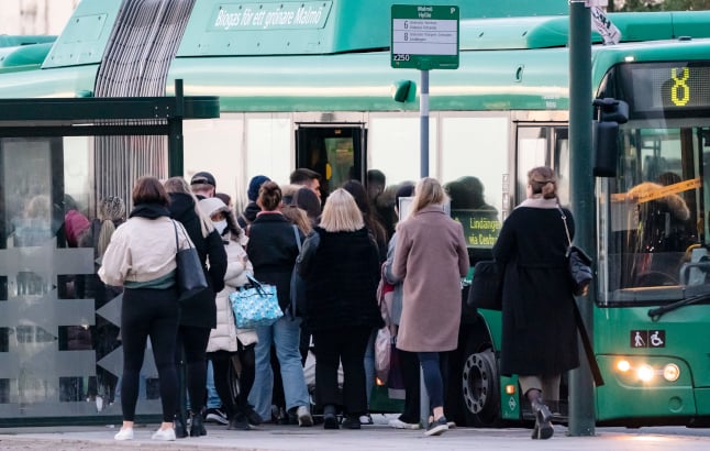
People queuing for a bus in Malmö on Tuesday. Photo: Johan Nilsson/TT
 

Skånetrafiken is so far the only regional transport company in Sweden offering customers the possibility of checking traffic in real-time. 
 
“We've seen Skånetrafiken has such an app, but we don't have the possibility of doing the same,” Claes Keisu, press spokesperson for the Stockholm region's public transport company SL, told The Local. 
 
He said that SL was many times bigger than Skånetrafiken with 2,200 buses and 30,000 bus journeys every day, only 30 percent of which were fitted with automatic passenger counting. 
 
“It would have to be a very large system to be able to have such a map,” he said. “We have automatic passenger counting in about 30 percent of our vehicles, but the data is saved on the buses and it is only we get to the depot that the information is downloaded,” he said. “We can't do it in real time.” 
 
“If you have as much volume as we have in our traffic, it's harder to enact these smart solutions in a cost-effective way.” 
 

Skånetrafiken's Linus Eriksson said on Tuesday that he expected the new coronavirus recommendations to bring the reduction in passengers back close to the 55 percent year-on-year drop seen in April and May. Even before the recommendations traffic was down about 40 percent year on year. 
 
“We already have a huge impact on the number of passengers. If you compare to April and May, when we had the largest fall, we were about 55 percent below the same period as last year, so I think we will come back up there, because there are quite a lot of people that need to go to work.” 
 
He said that the 40 percent drop had generally been sufficient to allow social distancing on buses and trains, but said that the travel map can help reduce congestion at peak travel times. 
 
“We have 13,000 bus starts every day, and we can see that most of them, 95 percent to 98 percent, have lots of space, but there's still some in the rush hour that we can see that they fill up, especially when school starts at 7.30 in the morning.”

Member comments

Log in here to leave a comment.
Become a Member to leave a comment.