SHARE
COPY LINK

WEATHER

France set for another scorcher as temperatures rise again

The mercury is rising across most of France on Tuesday while the west gets set for violent storms.

France set for another scorcher as temperatures rise again
Photo: AFP
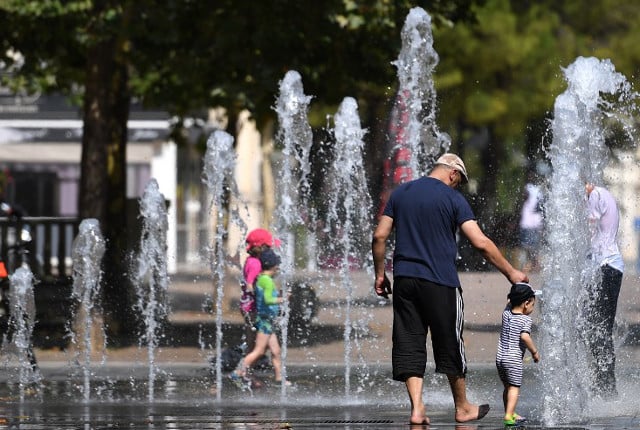
Scorching temperatures will hit most of France once again with Tuesday expected to be another scorcher in a summer that has been full of scorching days so far.
 
And while the mercury rises across most of the country, three departments in the north west of France have been placed on orange alert for violent storms.
 
But across most of the country people will be baking under the sun and dealing with roasting temperatures.
 
READ ALSO: 

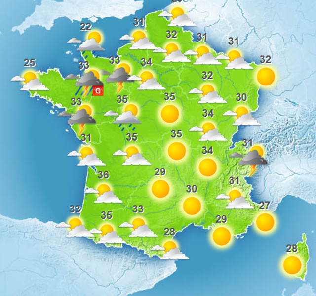
Weather predictions for Tuesday afternoon. Image: Meteo France 

In Paris, central France and parts of the south west, temperatures are expected to soar to highs of a whopping 37C, while in other parts of the south west and the Pyrenees, temperatures will be the highest in the country, at 38C. 
 
And even northern France won't be escape the sweltering temperatures with the Pas-de-Calais region predicted to reach up to 31C. 
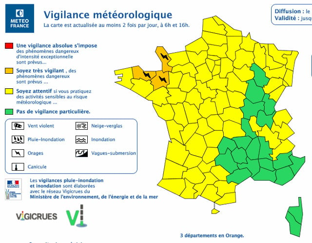
 
Image: Meteo France
 
At 6am Tuesday morning, the Côtes-d'Armor, l'Ille-et-Vilaine et la Manche, were placed on orange alert – the second highest warning level the agency issues and urges the public to be “very vigilant” – with the warning expected to be in place until 6am on Wednesday. 


WEATHER

Denmark records deepest snow level for 13 years

Blizzards in Denmark this week have resulted in the greatest depth of snow measured in the country for 13 years.

Denmark records deepest snow level for 13 years

A half-metre of snow, measured at Hald near East Jutland town Randers, is the deepest to have occurred in Denmark since January 2011, national meteorological agency DMI said.

The measurement was taken by the weather agency at 8am on Thursday.

Around 20-30 centimetres of snow was on the ground across most of northern and eastern Jutland by Thursday, as blizzards peaked resulting in significant disruptions to traffic and transport.

A much greater volume of snow fell in 2011, however, when over 100 centimetres fell on Baltic Sea island Bornholm during a post-Christmas blizzard, which saw as much as 135 centimetres on Bornholm at the end of December 2010.

READ ALSO: Denmark’s January storms could be fourth extreme weather event in three months

With snowfall at its heaviest for over a decade, Wednesday saw a new rainfall record. The 59 millimetres which fell at Svendborg on the island of Funen was the most for a January day in Denmark since 1886. Some 9 weather stations across Funen and Bornholm measured over 50cm of rain.

DMI said that the severe weather now looks to have peaked.

“We do not expect any more weather records to be set in the next 24 hours. But we are looking at some very cold upcoming days,” DMI meteorologist and press spokesperson Herdis Damberg told news wire Ritzau.

SHOW COMMENTS