
Scorching temperatures are set to hit France once again, particularly in the south west of the countr ywhere the mercury is expected to reach a roasting 35C, national weather agency Météo France has said.
And even though the temperatures are predicted to be at their highest in the south west of the country, the sunny weather is expected to hit the whole of France.
The weather map for Wednesday afternoon shows that the sun will be shining in most of the country (see below).
READ ALSO:
- Forecast: What weather is in store for France in summer 2017?
- Sixteen Paris parks to stay open 24-hours a day during summer
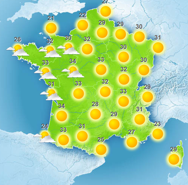
Map: Meteo France
On Wednesday afternoon, maximum temperatures are expected rise to 29C in the north of the country with highs of 33C in other parts of France.
Temperatures will remain around the 30C mark in much of the country until Friday, but storms are due to hit the north east of the country on Thursday afternoon/evening.
The weather map for Thursday afternoon shows the storms that will affect the far north of the country (see below).
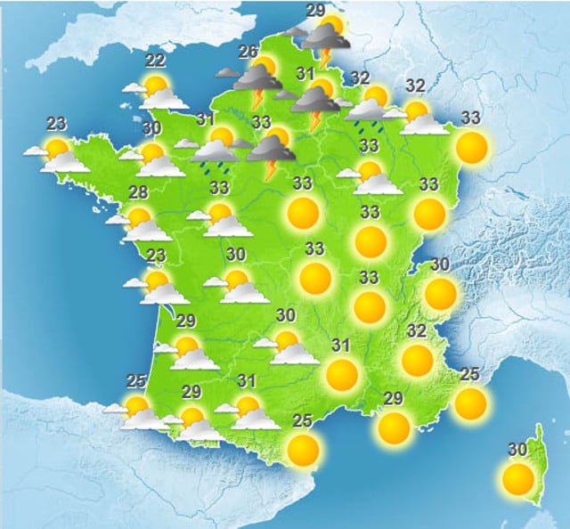
Map: Meteo France
On Friday afternoon, most of France will be sunny although there will be some showers in the north east (see map below).
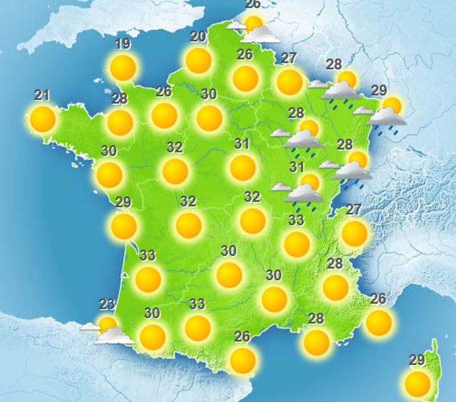
Map: Meteo France
In June, The Local reported that most of France experienced the hottest June night ever recorded as the average night-time temperature was a sweaty 26.4C. The record breaking night came at the end of a scorching heatwave that affected most of the country for several days, during which a whopping 67 departments were placed on alert for heatwaves.

Member comments