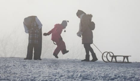
The German Weather Service (DWD) predicts widespread snowfall of 1-5cm in low-lying areas and up to 10cm at higher elevations on Friday, with rain only in the west and south-west of the country.
 Image: Deutsche Wetterdienst
Berlin had its dose of snow before the sun was even up on Friday, with picturesque results in some places.
#Berlin #snow update: it's snowing at Anhalter Bahnhof #snowbahn pic.twitter.com/zq8R0Dig1g
— Tom Barfield (@tombarfield) January 15, 2016
In the Black Forest, as much as 20-30cm of snow could fall over the course of 12 hours.
Temperatures will hover around or a little below freezing during the day – so watch out for ice and slush on the ground that could cause you problems whether you're driving or on foot.
Overnight, southern Germany is likely to see more snow, as well as the Erzgebirge (Ore mountains) in the East.
There may be storms in mountainous areas thanks to the changing wind direction and large amounts of snowfall.
Meanwhile, the North will see little snow but temperatures will still lie between -5 and 0C – meaning more slippery ice and slush to watch out for.
 Image: Deutsche Wetterdienst
Saturday will see cloudy skies with scattered snow, especially close to the Alps, with stormy spells in the north.
And on Sunday Germany will likely wake up to more fresh snow with more expected from heavy cloud in central and southern regions.
 Image: Deutsche Wetterdienst
Temperatures will top out at between -5 and -1C – so wrap up warm!

Member comments