
On Monday morning the front will bring storm force winds along with it which are set to hit the North Sea coast, reports the German Weather Service (DWD).
These wind will also blast down to the south and will be westerly and south westerly later in the day.
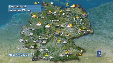
Hamburg and the north-west of the country are likely to see snowfall on Monday, while Munich in the south-east can expect milder temperatures of around nine degrees.
As the day progresses the winds will calm down in the north but will increase in intensity in the south. In the mountains they could reach speeds of 100 km/h. At the summits the storm will reach hurricane force levels of 130 km/h.
The cold front is also going to bring continued rain which fall fall until Tuesday morning. This will be particularly intense in the west of the country, with the Black Forest seeing some of the worst of the precipitation.
With the rain set to be more or less constant in the south, some areas will see rainfall of 60 to 80 litres per square meter (millimetres) over the next 48 hours.
Tuesday is the first day of meteorological winter, but as the week progresses temperatures will get milder.
As the week progresses the rain will ease off across the country and the winds will also pass. By the weekend the temperature will also become more agreeable, rising to averages between 7 and 12 degrees.


Member comments