SHARE
COPY LINK

WEATHER

Frost and snow comes to Austria

After a surprisingly mild start to November Austria is in for some icy temperatures this week, with snow and heavy rain forecast.

Frost and snow comes to Austria
Snow in Tyrol. File photo: APA/Liebl

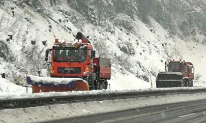
Tuesday night will see heavy rain and wind across the country and the snow line will drop to 800 metres.

In the south of the country, on the border with Italy, forecasters are warning of heavy rain on Tuesday followed by possible flooding and mudslides.

By Wednesday low lying areas will also be hit by colder temperatures. Innsbruck will see temperatures fall from plus three to minus three.

Only Vienna will have warmer temperatures, around plus nine. But as the weekend approaches it will get colder in the capital and across the country, with the snowline forecast to fall to 500 metres by Sunday.

Heavy snow is forecast along the main Alpine ridge.

Member comments

Log in here to leave a comment.
Become a Member to leave a comment.

WEATHER

IN PICTURES: ‘Exceptional’ Sahara dust cloud hits Europe

An "exceptional" dust cloud from the Sahara is choking parts of Europe, the continent's climate monitor said on Monday, causing poor air quality and coating windows and cars in grime.

IN PICTURES: 'Exceptional' Sahara dust cloud hits Europe

Copernicus Atmosphere Monitoring Service said the latest plume, the third of its kind in recent weeks, was bringing hazy conditions to southern Europe and would sweep northward as far as Scandinavia.

Mark Parrington, senior scientist at Copernicus, said the latest event was related to a weather pattern that has brought warmer weather to parts of Europe in recent days.

“While it is not unusual for Saharan dust plumes to reach Europe, there has been an increase in the intensity and frequency of such episodes in recent years, which could be potentially attributed to changes in atmospheric circulation patterns,” he said.

This latest episode has caused air quality to deteriorate in several countries, Copernicus said.

The European Union’s safe threshold for concentrations of PM10 — coarser particles like sand and dust that that can irritate the nose and throat — has already been exceeded in some locations.

A picture taken on April 8, 2024 shows a rapeseed field under thick sand dust blown in from the Sahara, giving the sky a yellowish appearance near Daillens, western Switzerland. – An “exceptional” dust cloud from the Sahara is choking parts of Europe, the continent’s climate monitor said, causing poor air quality and coating windows and cars in grime. (Photo by Fabrice COFFRINI / AFP)

The worst affected was the Iberian Peninsula in Spain but lesser air pollution spikes were also recorded in parts of Switzerland, France and Germany.

READ ALSO:

Local authorities in southeastern and southern France announced that the air pollution threshold was breached on Saturday.

They advised residents to avoid intense physical activity, particularly those with heart or respiratory problems.

The dust outbreak was expected to reach Sweden, Finland and northwest Russia before ending on Tuesday with a shift in weather patterns, Copernicus said.

The Sahara emits between 60 and 200 million tonnes of fine dust every year, which can travel thousands of kilometres (miles), carried by winds and certain meteorological conditions.

The Spanish Canary Islands off the coast of northwest Africa saw just 12 days within a 90-day period from December to February where skies were free of Saharan dust, the local weather agency Aemet had reported.

SHOW COMMENTS