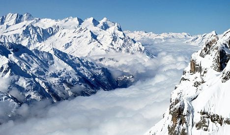
MeteoSwiss, the national weather office, says a cold front bringing air from the north will establish itself in Switzerland early on Saturday.
Periods of snow are expected at higher elevations later in the day, dropping to altitudes of 700 metres in western parts of the country, the weather office said.
The temperature will drop progressively below zero over the weekend.
Thermometer readings are not expected to rise above three or four degrees in much of the country on Sunday, except in Ticino were highs of nine are forecast at lower levels on Sunday.
Heavy snowfall is in the cards for many parts of the Alps on Saturday night, according to the Swiss Federal Institute for Snow and Avalanche Research.
The institute predicts between 20 and 40 centimetres of the white stuff will accumulate at the 2,500-metre level of the northern Alps and in Graubünden between Friday evening and Saturday evening.
Up to 20 centimetres is anticipated at the same altitude in the cantons of Valais and Ticino.
At lower levels, 10 to 20 centimetres of snow is expected on Saturday night, tapering off on Sunday.
The institute said the avalanche danger will rise over the weekend as a result of the fresh snowfall, particularly on north-facing slopes.
The outlook for Monday and Tuesday calls for clear and cold weather in most of Switzerland with a Bise wind blowing from the north-east in the Lake Geneva area.
Temperatures are forecast to rise gradually later in the week.


Member comments