SHARE
COPY LINK

WEATHER

Sunshine returns after heavy storms

Intense thunderstorms led to power cuts and flooding in parts of Sweden on Saturday, as the entire island of Gotland was left without electricity.

Sunshine returns after heavy storms

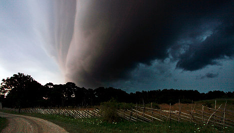
Starting in the south and moving up through the country, the blazing summer weather gave way to thunder and lightning and torrential downpours throughout the day. In the far south, Ronneby was hit by flooding in some 50 cellars.

“We got around 40 millimetres in half an hour. It was pretty heavy stuff,” said local fire chief Torbjörn Svensson.

At around 5pm lightning struck the power cables linking the Baltic island of Gotland to the mainland, depriving all 37,500 of Gotlands Energi AB’s customers of electricity. The company was able to resume some services by employing energy reserves from gas turbines in Slite.

By 9.30pm the mainland cable was fully operational and around 99 percent of customers had got their electricity back. The storm continued to hover over the island however and a number of houses were flooded. Emergency services were also kept fully occupied by automatic alarms activated by flashes of lightning.

Less severe storms were expected to hit Norrland on Sunday while the rest of the country can expect a gradual return to sunnier weather. Temperatures however will not reach the giddy heights of last week.

“It will be more like a normal Swedish summer with maximum temperatures of 25 to 26 degrees,” said Therese Fougman at meteorological agency SMHI.

Member comments

Log in here to leave a comment.
Become a Member to leave a comment.

WEATHER

Denmark records deepest snow level for 13 years

Blizzards in Denmark this week have resulted in the greatest depth of snow measured in the country for 13 years.

Denmark records deepest snow level for 13 years

A half-metre of snow, measured at Hald near East Jutland town Randers, is the deepest to have occurred in Denmark since January 2011, national meteorological agency DMI said.

The measurement was taken by the weather agency at 8am on Thursday.

Around 20-30 centimetres of snow was on the ground across most of northern and eastern Jutland by Thursday, as blizzards peaked resulting in significant disruptions to traffic and transport.

A much greater volume of snow fell in 2011, however, when over 100 centimetres fell on Baltic Sea island Bornholm during a post-Christmas blizzard, which saw as much as 135 centimetres on Bornholm at the end of December 2010.

READ ALSO: Denmark’s January storms could be fourth extreme weather event in three months

With snowfall at its heaviest for over a decade, Wednesday saw a new rainfall record. The 59 millimetres which fell at Svendborg on the island of Funen was the most for a January day in Denmark since 1886. Some 9 weather stations across Funen and Bornholm measured over 50cm of rain.

DMI said that the severe weather now looks to have peaked.

“We do not expect any more weather records to be set in the next 24 hours. But we are looking at some very cold upcoming days,” DMI meteorologist and press spokesperson Herdis Damberg told news wire Ritzau.

SHOW COMMENTS